Fitxer:Chile-Chonos Archipelago.jpg
Fitxer original (1.032 × 1.276 píxels, mida del fitxer: 572 Ko, tipus MIME: image/jpeg)
| Aquest fitxer i la informació mostrada a continuació provenen del dipòsit multimèdia lliure Wikimedia Commons. |
Resum
| Descripció |
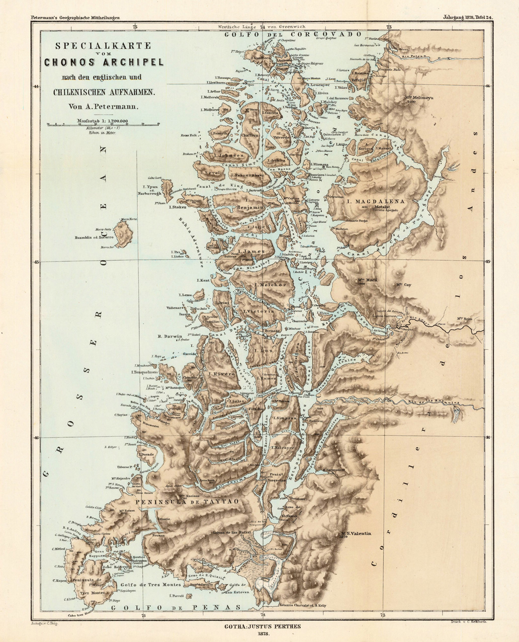
English: Lithograph, printed in colors when published. Detailled map, showing the Chonos Archipel from the gulf of Penas with the Peninsula de Taytao up to the gulf of Corcovado. Very detailled map with an enormous number of islands and peninsulas, most of them with place names. The map provides an overview of the results of the travel by Th. von Heugelin to Somalia. It is also ornated with a scene of birds and mammals, which were discovered by Th. Heugelin in Somalia. |
| Data | |
| Font | http://www.bergbook.com/htdocs/woda/data/demo/descriptions/17333.htm |
| Autor | Petermann, A. |
Llicència
|
Aquest material està en domini públic als Estats Units i als altres països on el dret d'autor s'estén per 70 anys (o menys) després de la mort de l'autor.
| |
| Aquest fitxer està identificat com a lliure de restriccions conegudes sota la llei de drets d'autor, inclosos els drets veïns. | |
Historial del fitxer
Cliqueu una data/hora per veure el fitxer tal com era aleshores.
| Data/hora | Miniatura | Dimensions | Usuari/a | Comentari | |
|---|---|---|---|---|---|
| actual | 04:43, 24 feb 2010 | | 1.032 × 1.276 (572 Ko) | Rec79 | {{Information |Description={{en|1=Lithograph, printed in colors when published. Detailled map, showing the Chonos Archipel from the gulf of Penas with the Peninsula de Taytao up to the gulf of Corcovado. Very detailled map with an enormous number of islan |
Ús del fitxer
La pàgina següent utilitza aquest fitxer:
Ús global del fitxer
Utilització d'aquest fitxer en altres wikis:
- Utilització a de.wikipedia.org
- Utilització a en.wikipedia.org
- Utilització a es.wikipedia.org
- Utilització a fr.wikipedia.org
- Utilització a fr.wiktionary.org
- Utilització a gl.wikipedia.org
- Utilització a it.wikipedia.org
- Utilització a lt.wikipedia.org
- Utilització a lv.wikipedia.org
- Utilització a nn.wikipedia.org
- Utilització a ru.wikipedia.org
- Utilització a sh.wikipedia.org
- Utilització a www.wikidata.org