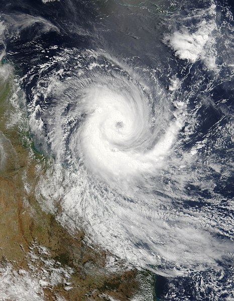
Fitxer:Cyclone Larry 19 mar 2006 0025Z.jpg

Mida d'aquesta previsualització: 466 × 599 píxels. Altres resolucions: 187 × 240 píxels | 373 × 480 píxels | 597 × 768 píxels | 796 × 1.024 píxels | 1.593 × 2.048 píxels | 5.600 × 7.200 píxels.
Fitxer original (5.600 × 7.200 píxels, mida del fitxer: 5,69 Mo, tipus MIME: image/jpeg)
Historial del fitxer
Cliqueu una data/hora per veure el fitxer tal com era aleshores.
| Data/hora | Miniatura | Dimensions | Usuari/a | Comentari | |
|---|---|---|---|---|---|
| actual | 22:29, 18 nov 2006 |  | 5.600 × 7.200 (5,69 Mo) | Good kitty | == Summary == {{Information |Description=Tropical Cyclone Larry formed off the northeastern coast of Australia on March 18, 2006, but built strength rapidly. When the Moderate Resolution Imaging Spectroradiometer (MODIS) on the Terra satellite observed th |
Ús del fitxer
Les 2 pàgines següents utilitzen aquest fitxer:
Ús global del fitxer
Utilització d'aquest fitxer en altres wikis:
- Utilització a ar.wikipedia.org
- Utilització a be.wikipedia.org
- Utilització a bn.wikipedia.org
- Utilització a cv.wikipedia.org
- Utilització a de.wikipedia.org
- Utilització a en.wikipedia.org
- Coral Sea
- Wikipedia:Selected anniversaries/March 20
- Cyclone Larry
- Portal:Environment
- Portal:Tropical cyclones/Did you know/Archive
- Portal:Tropical cyclones/Anniversaries
- Portal:Tropical cyclones/Anniversaries/March
- Portal:Tropical cyclones/Anniversaries/March/20
- Environmental threats to the Great Barrier Reef
- Wikipedia:Main Page history/2016 March 20
- Utilització a es.wikipedia.org
- Utilització a ga.wikipedia.org
- Utilització a he.wikipedia.org
- Utilització a krc.wikipedia.org
- Utilització a mhr.wikipedia.org
- Utilització a ms.wikipedia.org
- Utilització a pnb.wikipedia.org
- Utilització a ru.wikipedia.org
- Utilització a sr.wikipedia.org
- Utilització a uk.wikipedia.org
- Utilització a ur.wikipedia.org
- Utilització a zh.wikipedia.org


