Fitxer:Daedongyeojijeondo small.jpg

Fitxer original (700 × 1.165 píxels, mida del fitxer: 340 Ko, tipus MIME: image/jpeg)
| Aquest fitxer i la informació mostrada a continuació provenen del dipòsit multimèdia lliure Wikimedia Commons. |
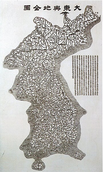
- Description:
- A map of Korea "大東與地全圖""대동여지전도", painted by Korean geograph 김정호(Kim Jeongho), dating from 1860, showing the "스시마 섬"(Tsushima Islands) as part of Korea.
|
Aquest material està en domini públic als Estats Units i als altres països on el dret d'autor s'estén per 70 anys (o menys) després de la mort de l'autor.
| |
| Aquest fitxer està identificat com a lliure de restriccions conegudes sota la llei de drets d'autor, inclosos els drets veïns. | |
Historial del fitxer
Cliqueu una data/hora per veure el fitxer tal com era aleshores.
| Data/hora | Miniatura | Dimensions | Usuari/a | Comentari | |
|---|---|---|---|---|---|
| actual | 09:22, 14 maig 2005 | | 700 × 1.165 (340 Ko) | Carnildo | '''Description:''' A map of Korea dating from 1860, showing the Tsushima Islands as part of Korea. {{PD}} Category:Maps of Korea |
Ús del fitxer
Les 2 pàgines següents utilitzen aquest fitxer:
Ús global del fitxer
Utilització d'aquest fitxer en altres wikis:
- Utilització a bo.wikipedia.org
- Utilització a en.wikipedia.org
- Korea
- History of South Korea
- Jiandao
- Gim Jeong-ho
- Coup d'état of December Twelfth
- Provisional Government of the Republic of Korea
- Geography of Korea
- First Republic of Korea
- United States Army Military Government in Korea
- April Revolution
- Supreme Council for National Reconstruction
- Second Republic of Korea
- Third Republic of Korea
- Fourth Republic of Korea
- Template:History of South Korea
- Fifth Republic of Korea
- Coup d'état of May Seventeenth
- Utilització a es.wikipedia.org
- Utilització a hi.wikipedia.org
- Utilització a id.wikipedia.org
- Utilització a it.wikiquote.org
- Utilització a ko.wikipedia.org
- Utilització a ms.wikipedia.org
- Sejarah Korea Selatan
- Templat:Sejarah Korea Selatan
- Pemerintahan Tentera Darat Amerika Syarikat di Korea
- Republik Pertama Korea Selatan
- Pengguna:Polar/Templat kembangan menegak
- Perjuangan Demokratik Jun
- Republik Kedua Korea Selatan
- Revolusi April
- Majlis Tertinggi Pembinaan Semula Negara
- Republik Ketiga Korea Selatan
- Republik Keempat Korea Selatan
- Republik Kelima Korea Selatan
- Rampasan kuasa 12 Disember
- Rampasan kuasa 17 Mei
- Utilització a my.wikipedia.org
- Utilització a sq.wikipedia.org
- Utilització a sv.wikipedia.org
- Utilització a ta.wikipedia.org
- Utilització a vi.wikipedia.org