Fitxer:Dakotatribesmap.jpg
Mida d'aquesta previsualització: 800 × 583 píxels. Altres resolucions: 320 × 233 píxels | 640 × 466 píxels | 891 × 649 píxels.
Fitxer original (891 × 649 píxels, mida del fitxer: 212 Ko, tipus MIME: image/jpeg)
| Aquest fitxer i la informació mostrada a continuació provenen del dipòsit multimèdia lliure Wikimedia Commons. |
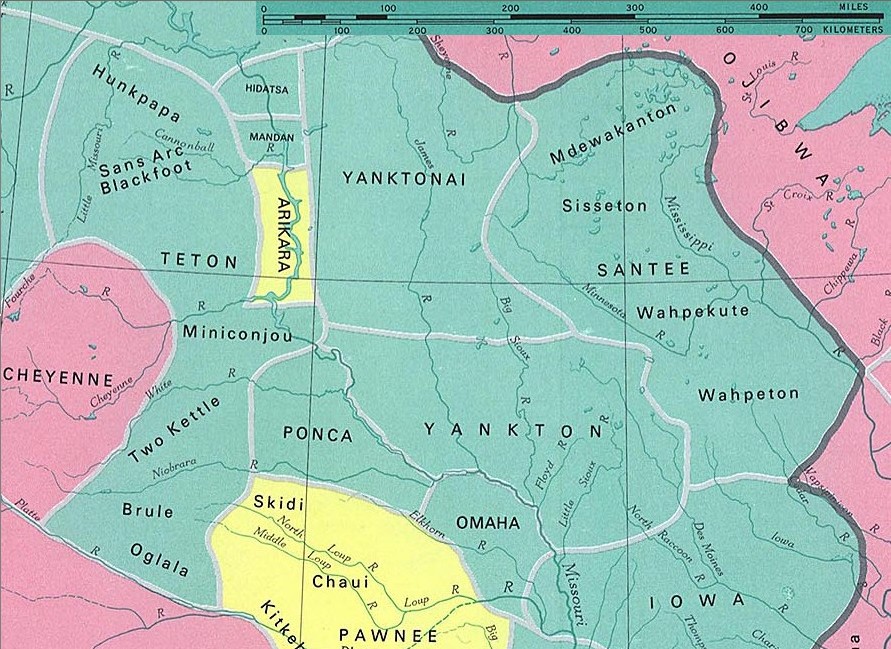
Dakota tribes
fragment from: http://www.lib.utexas.edu/maps/national_atlas_1970/ca000097.jpg
Most of the maps scanned by the University of Texas Libraries and served from this web site are in the public domain. No permissions are needed to copy them. You may download them and use them as you wish.
This file is in the public domain because Most of the maps scanned by the University of Texas Libraries and served from this web site (www.lib.utexas.edu) are in the public domain. No permissions are needed to copy them. You may download them and use them as you wish.
|
also see

Historial del fitxer
Cliqueu una data/hora per veure el fitxer tal com era aleshores.
| Data/hora | Miniatura | Dimensions | Usuari/a | Comentari | |
|---|---|---|---|---|---|
| actual | 01:37, 11 gen 2006 | | 891 × 649 (212 Ko) | Pitert | Dakota tribes fragment from: http://www.lib.utexas.edu/maps/national_atlas_1970/ca000097.jpg {{PD}} |
Ús del fitxer
La pàgina següent utilitza aquest fitxer:
Ús global del fitxer
Utilització d'aquest fitxer en altres wikis:
- Utilització a cs.wikipedia.org
- Utilització a es.wikipedia.org
- Utilització a fi.wikipedia.org
- Utilització a fr.wikipedia.org
- Utilització a ja.wikipedia.org
- Utilització a pl.wikipedia.org