Fitxer:EasternVirginia1775.jpg

Fitxer original (3.360 × 2.660 píxels, mida del fitxer: 2,84 Mo, tipus MIME: image/jpeg)
| Aquest fitxer i la informació mostrada a continuació provenen del dipòsit multimèdia lliure Wikimedia Commons. |
Resum
| Descripció |
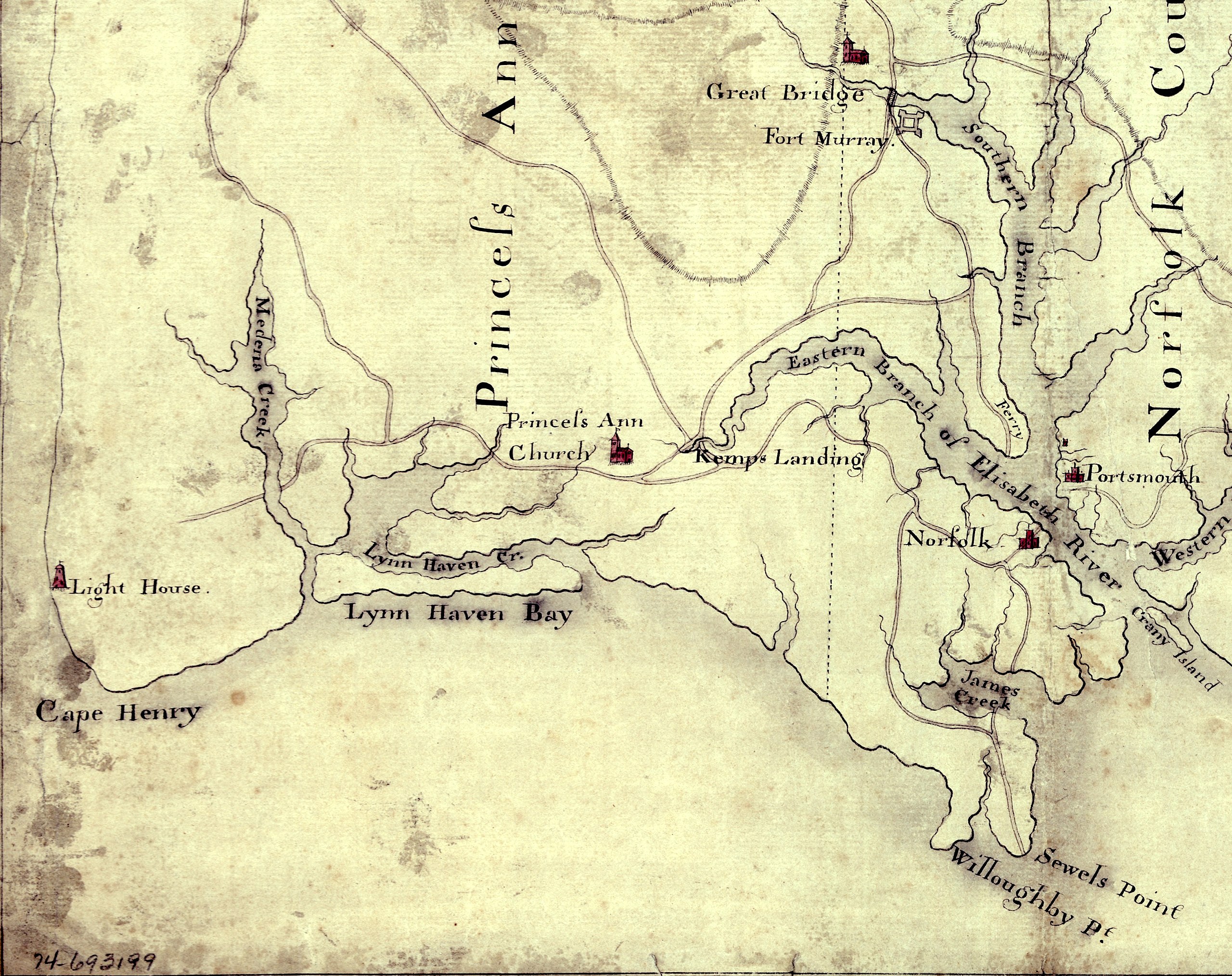
English: Detail of a 1780s manuscript map depicting the eastern coastal areas of Virginia, including portions of "Princess Anne" and Norfolk counties. The map is oriented with North to the bottom and South to the top. Part of the mouth of Chesapeake Bay is visible at the bottom of the map. The map depicts the sites of several military actions fought on land in the early days of the American Revolutionary War, including w:en:Battle of Kemp's Landing, w:en:Battle of Great Bridge, and the w:en:Burning of Norfolk, and the site of two sea battles of the war, the First and Second Battles of the Capes, the latter also known as w:en:Battle of the Chesapeake. |
||
| Data | cap a 1785 (Following a logistical and political delay of about 17 years, construction of the Cape Henry Lighthouse w:en:Cape Henry Light, depicted on the map, began about 1791 and was completed in 1792), LC claims "1779?;" Worldcat [1] claims "1785?". [See also "Early Map of First Colony’s Easternmost Landscape, Landmarks and Landowners"[2].]Hogident (discussió) 08:12, 26 January 2015 (UTC) | ||
| Font |
|
||
| Autor | Desconegut | ||
| Permís (Com reutilitzar aquest fitxer) |
[NP: Request a change in file name, since it contains a contradiction in the date(s) of the map.] |

Llicència
|
Aquest material està en domini públic als Estats Units i als altres països on el dret d'autor s'estén per 70 anys (o menys) després de la mort de l'autor.
| |
| Aquest fitxer està identificat com a lliure de restriccions conegudes sota la llei de drets d'autor, inclosos els drets veïns. | |
Historial del fitxer
Cliqueu una data/hora per veure el fitxer tal com era aleshores.
| Data/hora | Miniatura | Dimensions | Usuari/a | Comentari | |
|---|---|---|---|---|---|
| actual | 17:58, 5 ago 2010 | | 3.360 × 2.660 (2,84 Mo) | Magicpiano | {{Information |Description={{en|Detail of a 1770s manuscript map depicting the eastern coastal areas of Virginia, including portions of Princess Ann and Norfolk Counties. The map is oriented with North to the bottom and South to the top. Part of the |
Ús del fitxer
La pàgina següent utilitza aquest fitxer:
Ús global del fitxer
Utilització d'aquest fitxer en altres wikis:
- Utilització a en.wikipedia.org
- Utilització a fi.wikipedia.org
- Utilització a fr.wikipedia.org
- Utilització a ja.wikipedia.org
- Utilització a pt.wikipedia.org
- Utilització a ru.wikipedia.org
- Utilització a www.wikidata.org