Fitxer:Eq Guinea ES.PNG
No hi ha cap versió amb una resolució més gran.
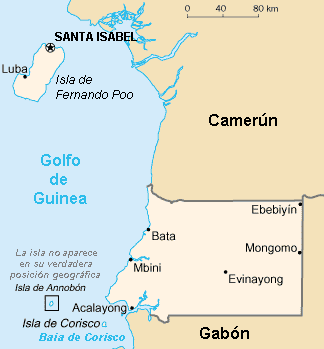
Eq_Guinea_ES.PNG (324 × 349 píxels, mida del fitxer: 7 Ko, tipus MIME: image/png)
| Aquest fitxer i la informació mostrada a continuació provenen del dipòsit multimèdia lliure Wikimedia Commons. |
Mapa de Guinea Ecuatorial en español / Equatorial Guinea in Spanish--revision of World Fact Book map
This image is in the public domain because it contains materials that originally came from the United States Central Intelligence Agency's World Factbook.
|
 |
Historial del fitxer
Cliqueu una data/hora per veure el fitxer tal com era aleshores.
| Data/hora | Miniatura | Dimensions | Usuari/a | Comentari | |
|---|---|---|---|---|---|
| actual | 05:50, 12 feb 2022 | | 324 × 349 (7 Ko) | Lojwe | Frame removed |
| 17:39, 30 juny 2011 |  | 330 × 355 (9 Ko) | Galjundi7 | Old names of the cities during the Spanish occupation | |
| 17:38, 30 juny 2011 |  | 330 × 355 (9 Ko) | Galjundi7 | Old names of the cities during the Spanish occupation | |
| 11:45, 19 maig 2005 |  | 330 × 355 (10 Ko) | Danny~commonswiki | {{GFDL}} Equatorial Guinea map in Spanish, based on the World Fact Book | |
| 12:21, 18 maig 2005 |  | 330 × 355 (10 Ko) | Danny~commonswiki | {{GFDL)) Equatorial Guinea in Spanish--revision of World Fact Book map |
Ús del fitxer
Les 4 pàgines següents utilitzen aquest fitxer:
Ús global del fitxer
Utilització d'aquest fitxer en altres wikis:
- Utilització a ast.wikipedia.org
- Utilització a azb.wikipedia.org
- Utilització a be.wikipedia.org
- Utilització a en.wikipedia.org
- Utilització a es.wikipedia.org
- Utilització a fr.wikipedia.org
- Utilització a gag.wikipedia.org
- Utilització a gl.wikipedia.org
- Utilització a hy.wikipedia.org
- Utilització a ia.wikipedia.org
- Utilització a la.wikipedia.org
- Utilització a oc.wikipedia.org
- Utilització a pt.wikipedia.org
- Utilització a ru.wikipedia.org
- Utilització a uk.wikipedia.org
- Utilització a www.wikidata.org