Fitxer:Ghana Map.jpg

Mida d'aquesta previsualització: 489 × 599 píxels. Altres resolucions: 196 × 240 píxels | 392 × 480 píxels | 627 × 768 píxels | 1.060 × 1.298 píxels.
Fitxer original (1.060 × 1.298 píxels, mida del fitxer: 309 Ko, tipus MIME: image/jpeg)
| Aquest fitxer i la informació mostrada a continuació provenen del dipòsit multimèdia lliure Wikimedia Commons. |
Resum
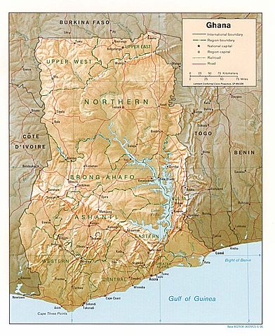
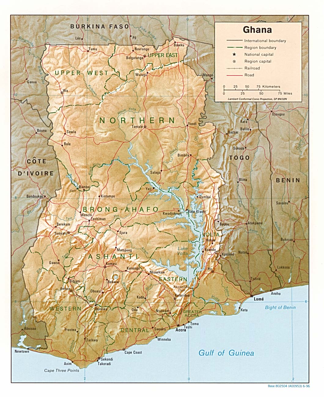
| Descripció | Shaded relief map of Ghana, 1996, produced by the U.S. Central Intelligence Agency. |
| Data | |
| Font | University of Texas Libraries, Perry-Castañeda Library Map Collection: Ghana maps |
| Autor | CIA |
Llicència
| This image is a work of a Central Intelligence Agency employee, taken or made as part of that person's official duties. As a Work of the United States Government, this image or media is in the public domain in the United States.
|

|
Historial del fitxer
Cliqueu una data/hora per veure el fitxer tal com era aleshores.
| Data/hora | Miniatura | Dimensions | Usuari/a | Comentari | |
|---|---|---|---|---|---|
| actual | 20:46, 3 ago 2006 | | 1.060 × 1.298 (309 Ko) | DO11.10 | Shaded relief map of Ghana. Image source: [http://www.lib.utexas.edu/maps/africa/ghana_rel95.jpg], from the [http://www.lib.utexas.edu/maps/ghana.html Perry-Castañeda Library Map Collection]. {{PD-USGov-CIA}} Category:Maps of Ghana |
| 12:50, 21 feb 2006 |  | 1.341 × 1.653 (570 Ko) | Lupo | Shaded relief map of Ghana. Image source: [http://www.lib.utexas.edu/maps/africa/ghana_rel95.jpg], from the [http://www.lib.utexas.edu/maps/ghana.html Perry-Castañeda Library Map Collection]. {{PD-USGov-CIA}} Category:Maps of Ghana |
Ús del fitxer
No hi ha pàgines que utilitzin aquest fitxer.
Ús global del fitxer
Utilització d'aquest fitxer en altres wikis:
- Utilització a ast.wikipedia.org
- Utilització a avk.wikipedia.org
- Utilització a br.wikipedia.org
- Utilització a de.wikipedia.org
- Utilització a el.wikipedia.org
- Utilització a en.wikipedia.org
- Utilització a es.wikipedia.org
- Utilització a fa.wikipedia.org
- Utilització a fr.wikipedia.org
- Utilització a gag.wikipedia.org
- Utilització a gd.wikipedia.org
- Utilització a gl.wikipedia.org
- Utilització a hr.wiktionary.org
- Utilització a id.wikipedia.org
- Utilització a it.wikipedia.org
- Utilització a lfn.wikipedia.org
- Utilització a lt.wikipedia.org
- Utilització a ms.wikipedia.org
- Utilització a pl.wikipedia.org
- Utilització a simple.wikipedia.org
- Utilització a sr.wikipedia.org
- Utilització a tr.wikipedia.org
- Utilització a uk.wikipedia.org
- Utilització a vec.wikipedia.org
- Utilització a wa.wikipedia.org
- Utilització a yo.wikipedia.org
- Utilització a zh.wikipedia.org