Fitxer:Helen Reef.png
Mida d'aquesta previsualització: 359 × 598 píxels. Altres resolucions: 144 × 240 píxels | 288 × 480 píxels | 892 × 1.487 píxels.
Fitxer original (892 × 1.487 píxels, mida del fitxer: 90 Ko, tipus MIME: image/png)
| Aquest fitxer i la informació mostrada a continuació provenen del dipòsit multimèdia lliure Wikimedia Commons. |
Resum
| Descripció |
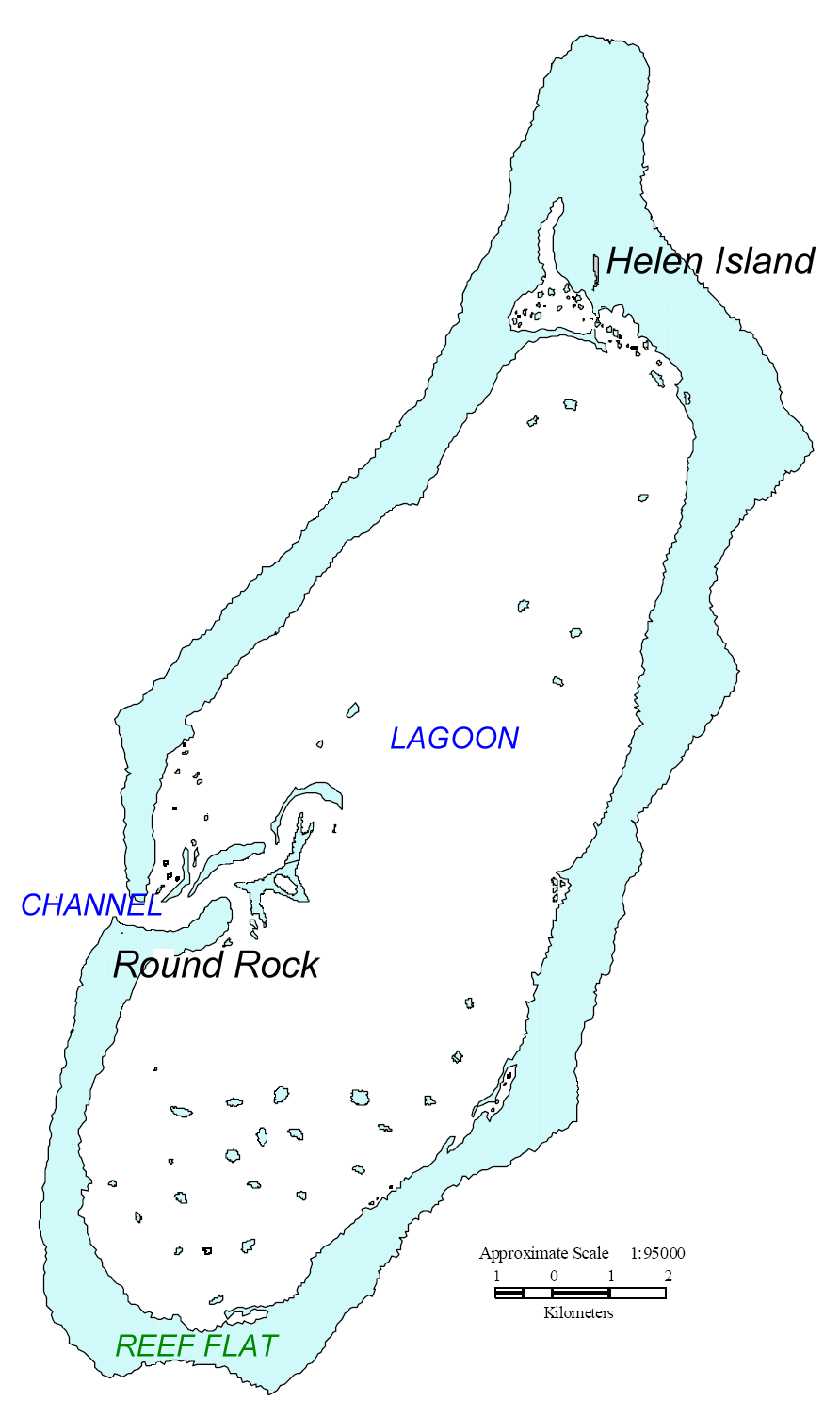
English: Map of Helen Reef, Palau. Based on map from U.S. Minerals Management Service. |
| Data | |
| Font | original source: http://tobi.gmu.edu/thisisnow/Helen%20Reef%202000%20Monitoring%20Expedition.pdf, processed by Ratzer. |
| Autor | U.S. Minerals Management Service |
Llicència
| This article or image contains material based on a work of a Minerals Management Service employee, created as part of that person's official duties. As a work of the U.S. federal government, such work is in the public domain in the United States. See MMS Disclaimer. |  |
Registre original de càrregues
| date/time | username | Dimensions | File Size | edit summary |
|---|---|---|---|---|
| 11:46, 17 July 2006 | Ratzer | 892×1487 | 90 KB | base map from U.S. Minerals Management Service, Mapping and Boundary Branch (as explained on page http://cas.gmu.edu/~tobi/thisisnow/Helen%20Reef%202000%20Monitoring%20Expedition.pdf), processed by me |
Historial del fitxer
Cliqueu una data/hora per veure el fitxer tal com era aleshores.
| Data/hora | Miniatura | Dimensions | Usuari/a | Comentari | |
|---|---|---|---|---|---|
| actual | 12:04, 2 maig 2008 | | 892 × 1.487 (90 Ko) | Telim tor | == Information == {{Information |Description=Map of Helen Reef, Palau. Based on map from U.S. Minerals Management Service Boundary Branch |Source=original source: http://cas.gmu.edu/~tobi/thisisnow/Helen%20Reef%202000%20Monitoring%20Expedition.pdf Proce |
Ús del fitxer
La pàgina següent utilitza aquest fitxer:
Ús global del fitxer
Utilització d'aquest fitxer en altres wikis:
- Utilització a az.wikipedia.org
- Utilització a de.wikipedia.org
- Utilització a en.wikipedia.org
- Utilització a es.wikipedia.org
- Utilització a ja.wikipedia.org
- Utilització a lt.wikipedia.org
- Utilització a mk.wikipedia.org
- Utilització a nl.wikipedia.org
- Utilització a ru.wikipedia.org
- Utilització a www.wikidata.org