Fitxer:Hungarian autonomous province02.png
Mida d'aquesta previsualització: 619 × 599 píxels. Altres resolucions: 248 × 240 píxels | 496 × 480 píxels | 751 × 727 píxels.
Fitxer original (751 × 727 píxels, mida del fitxer: 60 Ko, tipus MIME: image/png)
| Aquest fitxer i la informació mostrada a continuació provenen del dipòsit multimèdia lliure Wikimedia Commons. |

|
Aquesta imatge (de tipus mapa) s'hauria de tornar a crear utilitzant gràfics vectorials com ara un fitxer SVG. Això té diversos avantatges; en trobareu més informació a Commons:Media for cleanup. Si ja disposeu d'una versió d'aquesta imatge en format SVG, us preguem que la pengeu; després, reemplaceu aquesta plantilla amb la plantilla {{Vector version available|nom nou de la imatge.svg}} en aquesta imatge.
|
Resum
| Descripció |
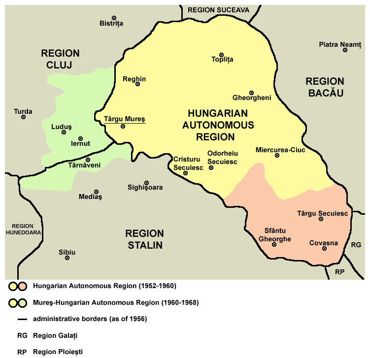
English: Map of the Hungarian Autonomous Region / Magyar Autonomous Region (1952-1960) and Mureş-Hungarian Autonomous Region / Mureş-Magyar Autonomous Region (1960-1968). |
| Data | |
| Font | Transferred from en.wikipedia |
| Autor | PANONIAN (discussió · contribucions) |
Llicència
| Jo, el titular del copyright d'aquesta obra, l'allibero al domini públic. Això s'aplica a tot el món. En alguns països això pot no ser legalment possible, en tal cas: Jo faig concessió a tothom del dret d'usar aquesta obra per a qualsevol propòsit, sense cap condició llevat d'aquelles requerides per la llei. |

|
This map has been uploaded by Electionworld from en.wikipedia.org to enable the |
References
Primary reference:
Secondary references:
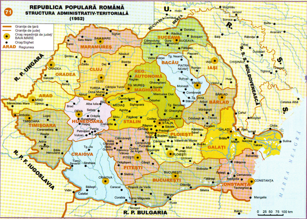
- http://www.adevarul.ro/bbtcontent/clipping/ADVIMA20110612_0443/1.jpg
- http://www.hungarian-human-rights.eu/images/rpr_1952.jpg
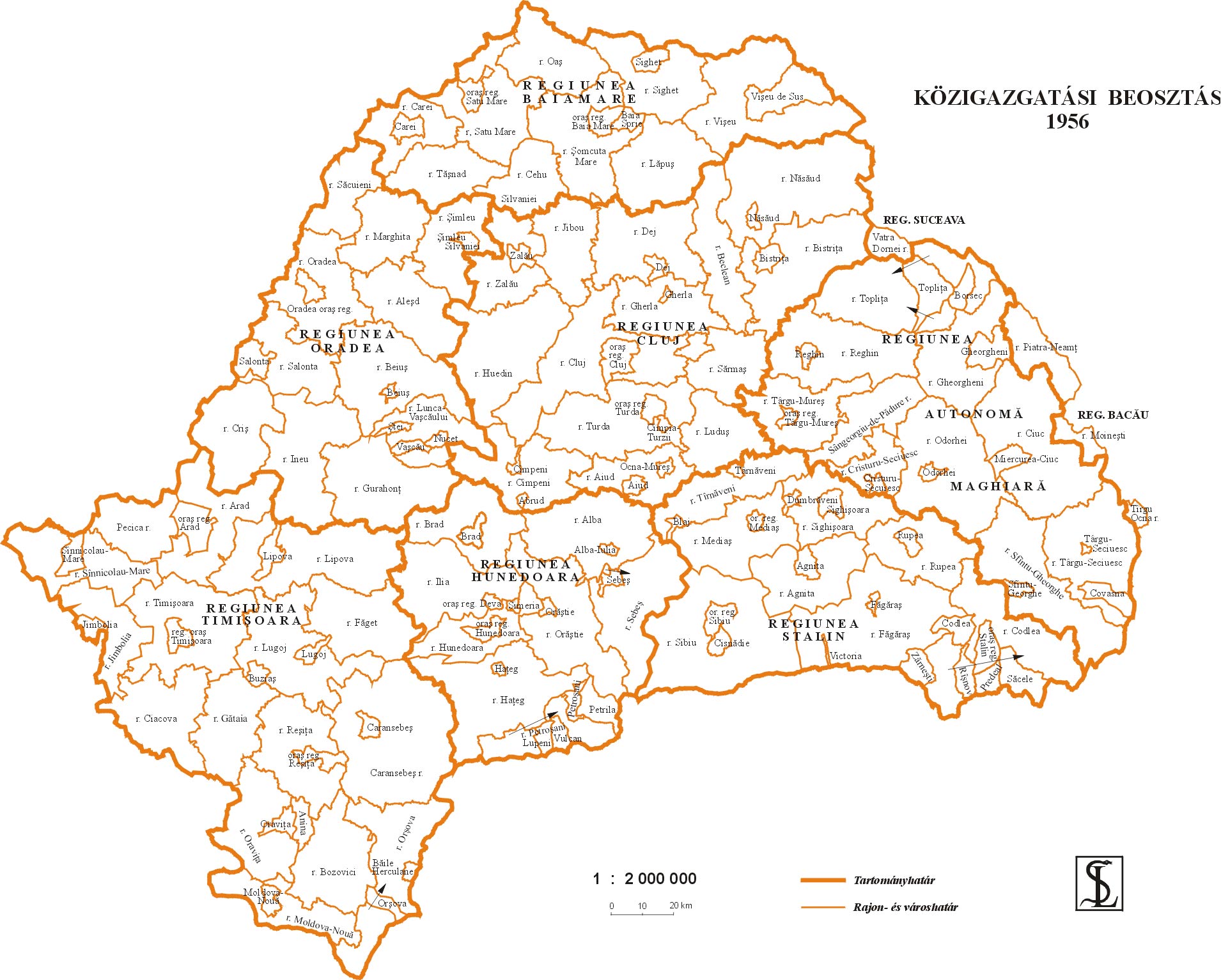
- http://sebok1.adatbank.transindex.ro/kepek/erd1956.jpg
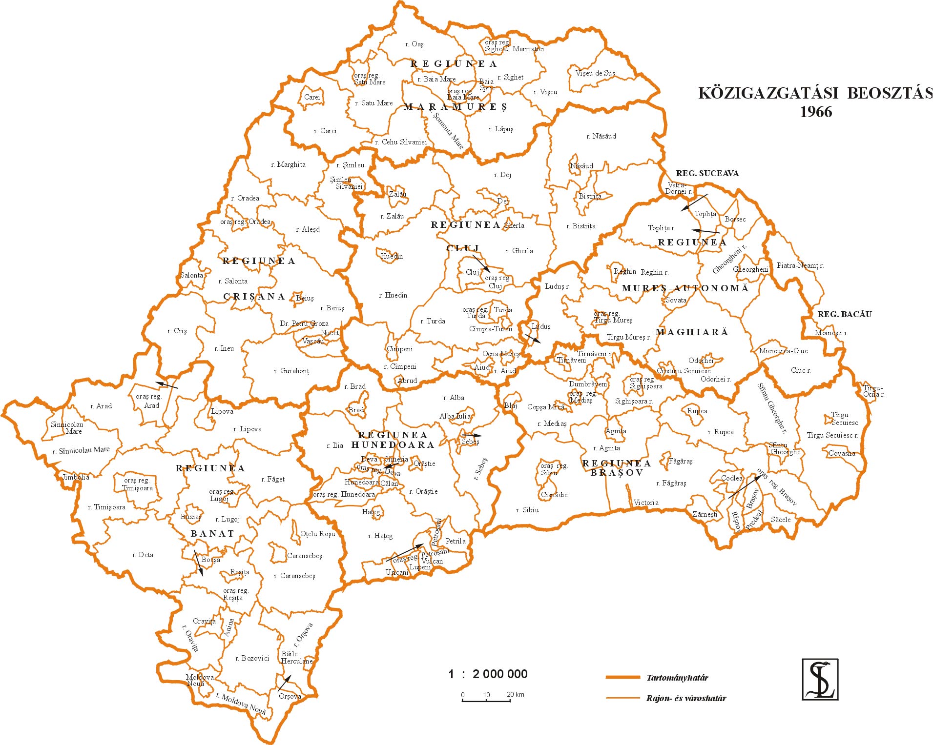
- http://sebok1.adatbank.transindex.ro/kepek/erd1966.jpg
- http://2.bp.blogspot.com/_yYcDY0o6YEA/SXaL1dSAXGI/AAAAAAAAAFk/21nu4zMSKJ8/s600/RO1960-1968.jpg
Historial del fitxer
Cliqueu una data/hora per veure el fitxer tal com era aleshores.
| Data/hora | Miniatura | Dimensions | Usuari/a | Comentari | |
|---|---|---|---|---|---|
| actual | 20:59, 26 març 2013 | | 751 × 727 (60 Ko) | PANONIAN | Reverted to version as of 13:05, 24 October 2011 I do not agree with your changes, please upload your file under different name |
| 11:09, 26 març 2013 |  | 619 × 599 (103 Ko) | Rgvis | Improved version with administrative borders changes shown during the existance of the Soviet-inspired administrative and territorial organisation in Communist Romania (1950-1968). | |
| 15:05, 24 oct 2011 |  | 751 × 727 (60 Ko) | PANONIAN | improved version | |
| 20:56, 28 des 2006 |  | 716 × 620 (11 Ko) | Electionworld | {{ew|en|PANONIAN}} map of the Hungarian Autonomous Province (self made) {{PD-self}} Category:Maps of the history of Romania |
Ús del fitxer
La pàgina següent utilitza aquest fitxer:
Ús global del fitxer
Utilització d'aquest fitxer en altres wikis:
- Utilització a ar.wikipedia.org
- Utilització a be.wikipedia.org
- Utilització a bg.wikipedia.org
- Utilització a en.wikipedia.org
- Utilització a es.wikipedia.org
- Utilització a fr.wikipedia.org
- Utilització a hu.wikipedia.org
- Utilització a it.wikipedia.org
- Utilització a mk.wikipedia.org
- Utilització a nl.wikipedia.org
- Utilització a pl.wikipedia.org
- Utilització a pt.wikipedia.org
- Utilització a ro.wikipedia.org
- Utilització a ru.wikipedia.org
- Utilització a sl.wikipedia.org
- Utilització a sr.wikipedia.org
- Utilització a uk.wikipedia.org
- Utilització a www.wikidata.org