Fitxer:Isle of Wight outline map with UK.png

Mida d'aquesta previsualització: 800 × 506 píxels. Altres resolucions: 320 × 203 píxels | 640 × 405 píxels | 907 × 574 píxels.
Fitxer original (907 × 574 píxels, mida del fitxer: 96 Ko, tipus MIME: image/png)
| Aquest fitxer i la informació mostrada a continuació provenen del dipòsit multimèdia lliure Wikimedia Commons. |

|
Aquesta imatge (de tipus locator map) s'hauria de tornar a crear utilitzant gràfics vectorials com ara un fitxer SVG. Això té diversos avantatges; en trobareu més informació a Commons:Media for cleanup. Si ja disposeu d'una versió d'aquesta imatge en format SVG, us preguem que la pengeu; després, reemplaceu aquesta plantilla amb la plantilla {{Vector version available|nom nou de la imatge.svg}} en aquesta imatge.
|
Resum
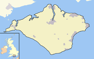
An outline map of the Isle of Wight for use within templates on Wikipedia.
Own work - created 12th April 2007 - derived from data from the OpenStreetMap project
Llicència
Jo, el titular dels drets d'autor d'aquest treball, el public sota la següent llicència:
Aquest fitxer està publicat sota la llicència de Creative Commons Reconeixement i Compartir Igual 2.0 Genèrica.
- Sou lliure de:
- compartir – copiar, distribuir i comunicar públicament l'obra
- adaptar – fer-ne obres derivades
- Amb les condicions següents:
- reconeixement – Heu de donar la informació adequada sobre l'autor, proporcionar un enllaç a la llicència i indicar si s'han realitzat canvis. Podeu fer-ho amb qualsevol mitjà raonable, però de cap manera no suggereixi que l'autor us dóna suport o aprova l'ús que en feu.
- compartir igual – Si modifiqueu, transformeu, o generareu amb el material, haureu de distribuir les vostres contribucions sota una llicència similar o una de compatible com l'original
Historial del fitxer
Cliqueu una data/hora per veure el fitxer tal com era aleshores.
| Data/hora | Miniatura | Dimensions | Usuari/a | Comentari | |
|---|---|---|---|---|---|
| actual | 05:00, 21 des 2007 | | 907 × 574 (96 Ko) | Jza84 | Fixing some minor pantone and composition issues |
| 21:20, 12 abr 2007 |  | 907 × 574 (44 Ko) | RichardB | ||
| 21:17, 12 abr 2007 |  | 907 × 574 (44 Ko) | RichardB | An outline map of the Isle of Wight for use within templates on Wikipedia. Own work - created 12th April 2007 - derived from data from the OpenStreetMap project | |
| 03:14, 12 abr 2007 |  | 907 × 574 (44 Ko) | RichardB | An outline map of the Isle of Wight for use within templates on Wikipedia. Own work - created 12th April 2007 - derived from data from the OpenStreetMap project |
Ús del fitxer
La pàgina següent utilitza aquest fitxer:
Ús global del fitxer
Utilització d'aquest fitxer en altres wikis:
- Utilització a en.wikipedia.org
- Utilització a vi.wikipedia.org