Fitxer:Jumbuck Hill Park hillside from Brigadoon after 2021 wooroloo bushfire.jpg
Mida d'aquesta previsualització: 800 × 426 píxels. Altres resolucions: 320 × 170 píxels | 640 × 341 píxels | 1.024 × 545 píxels | 1.280 × 681 píxels | 3.553 × 1.891 píxels.
Fitxer original (3.553 × 1.891 píxels, mida del fitxer: 2,44 Mo, tipus MIME: image/jpeg)
| Aquest fitxer i la informació mostrada a continuació provenen del dipòsit multimèdia lliure Wikimedia Commons. |
Resum
| Descripció |
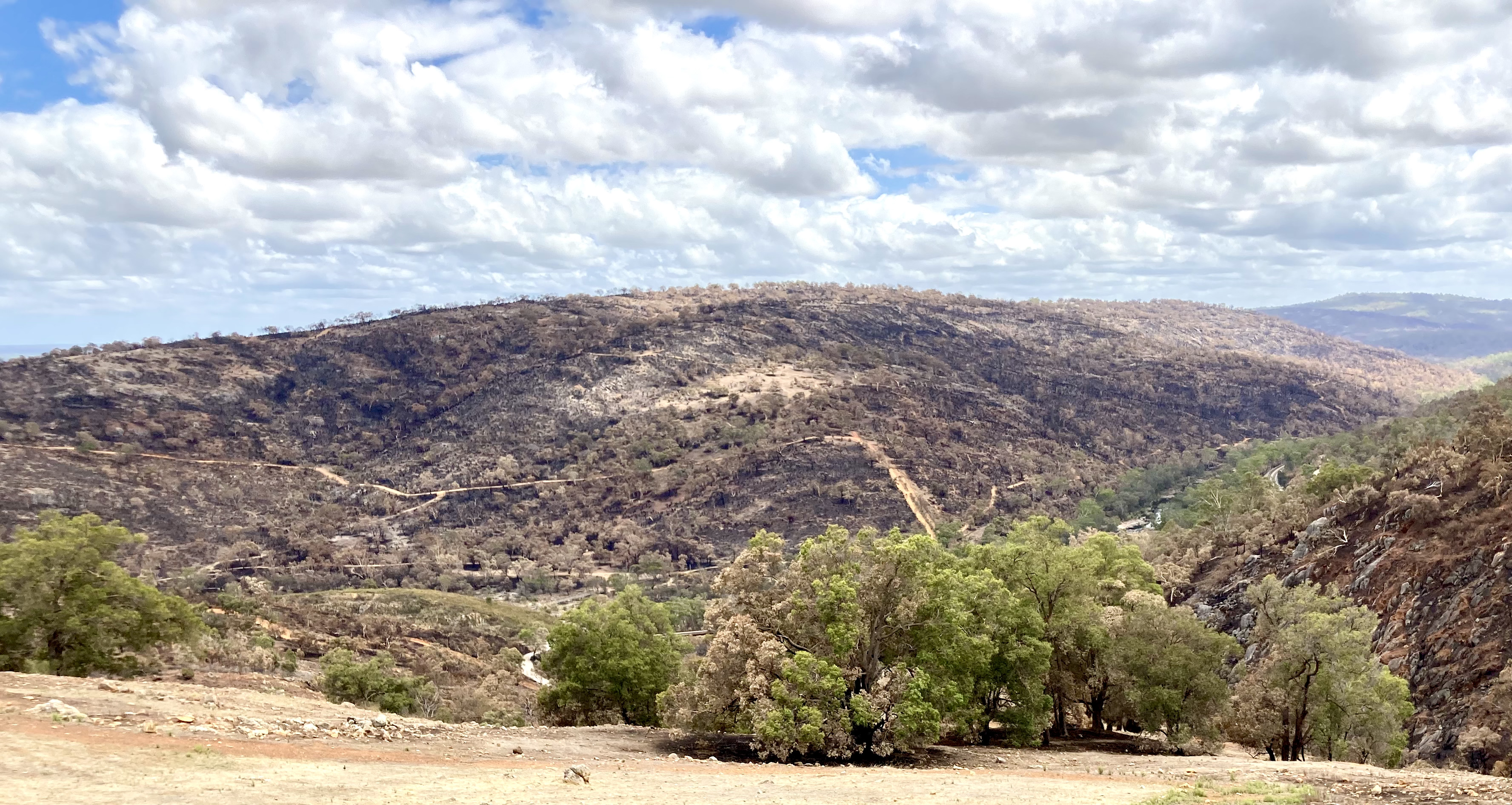
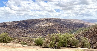
English: Jumbuck Hill Park hillside from Brigadoon, Western Australia after the 2021 Wooroloo Bushfire.
The Hill is known as Jumbuck Hill. Walyunga National Park to the right - north. |
| Data | |
| Font | Treball propi |
| Autor | JarrahTree |
| Posició de la càmera | | Aquesta i altres imatges properes a: OpenStreetMap |
|---|
Llicència
I User:JarrahTree hereby publish Jumbuck Hill Park hillside from Brigadoon after 2021 wooroloo bushfire.jpg under Creative Commons Attribution 2.5 Australia License
Attribution requirement;
Photographs by JarrahTree...commons.wikimedia.org
| process functionality required template |
|---|
| process functionality requires a generic template that best reflected image licensing as prescribed above on the 13 September 2012, where there is any difference/conflict/decrepency between what is described above as the image license and this template the above license as indicated takes precedence
JarrahTree, el titular dels drets d'autor d'aquest treball, el public sota la següent llicència: Aquest fitxer està disponible sota la llicència Creative Commons Reconeixement 2.5 Austràlia. Reconeixement: Photographs by JarrahTree...commons.wikimedia.org
 |
Historial del fitxer
Cliqueu una data/hora per veure el fitxer tal com era aleshores.
| Data/hora | Miniatura | Dimensions | Usuari/a | Comentari | |
|---|---|---|---|---|---|
| actual | 12:30, 10 feb 2021 | | 3.553 × 1.891 (2,44 Mo) | JarrahTree | Uploaded own work with UploadWizard |
Ús del fitxer
La pàgina següent utilitza aquest fitxer:
Ús global del fitxer
Utilització d'aquest fitxer en altres wikis:
- Utilització a en.wikipedia.org