Fitxer:Map Parthian Empire-fr.png
Mida d'aquesta previsualització: 800 × 414 píxels. Altres resolucions: 320 × 166 píxels | 640 × 331 píxels | 1.024 × 530 píxels | 1.766 × 914 píxels.
Fitxer original (1.766 × 914 píxels, mida del fitxer: 351 Ko, tipus MIME: image/png)
| Aquest fitxer i la informació mostrada a continuació provenen del dipòsit multimèdia lliure Wikimedia Commons. |
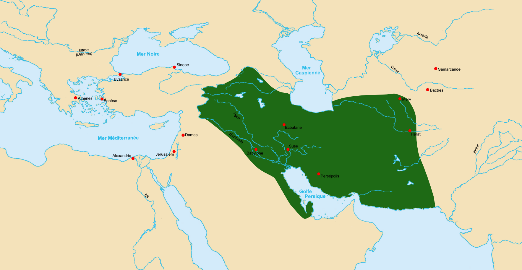
| Descripció | Map of Parthian Empire ca 60 BCE. |
| Data | |
| Font | Made using Image:LocationParthia.PNG as a source. |
| Autor | Fabienkhan |
| Permís (Com reutilitzar aquest fitxer) |
Jo, el titular dels drets d'autor d'aquest treball, el public sota la següent llicència: Aquest fitxer està publicat sota la llicència de Creative Commons Reconeixement i Compartir Igual 2.5 Genèrica.
|
| Altres versions | Derivative works of this file: Map Parthian Empire-bg.png |
Historial del fitxer
Cliqueu una data/hora per veure el fitxer tal com era aleshores.
| Data/hora | Miniatura | Dimensions | Usuari/a | Comentari | |
|---|---|---|---|---|---|
| actual | 17:25, 7 oct 2006 | | 1.766 × 914 (351 Ko) | Fabienkhan | {{Information |Description=Map of Parthian Empire ca 60 BCE. |Source=Made using Image:LocationParthia.PNG as a source. |Date=7 october 2006 |Author=Fabienkhan |Permission={{self|cc-by-sa-2.5}} |other_versions= }} [[Category:His |
Ús del fitxer
La pàgina següent utilitza aquest fitxer:
Ús global del fitxer
Utilització d'aquest fitxer en altres wikis:
- Utilització a bg.wikipedia.org
- Utilització a cs.wikipedia.org
- Utilització a en.wikipedia.org
- Utilització a eu.wikipedia.org
- Utilització a fr.wikipedia.org
- Utilització a ja.wikipedia.org
- Utilització a ka.wikipedia.org
- Utilització a ku.wikipedia.org
- Utilització a mg.wikipedia.org
- Utilització a nl.wikipedia.org
- Utilització a pl.wikipedia.org
- Utilització a sv.wikipedia.org
- Utilització a tr.wikipedia.org
- Utilització a vi.wikipedia.org
- Utilització a www.wikidata.org