Fitxer:Map of Malta 2.png
Mida d'aquesta previsualització: 531 × 599 píxels. Altres resolucions: 213 × 240 píxels | 425 × 480 píxels | 987 × 1.114 píxels.
Fitxer original (987 × 1.114 píxels, mida del fitxer: 1,34 Mo, tipus MIME: image/png)
| Aquest fitxer i la informació mostrada a continuació provenen del dipòsit multimèdia lliure Wikimedia Commons. |

|
This map has been uploaded by Electionworld from en.wikipedia.org to enable the |
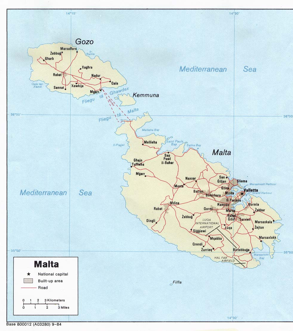
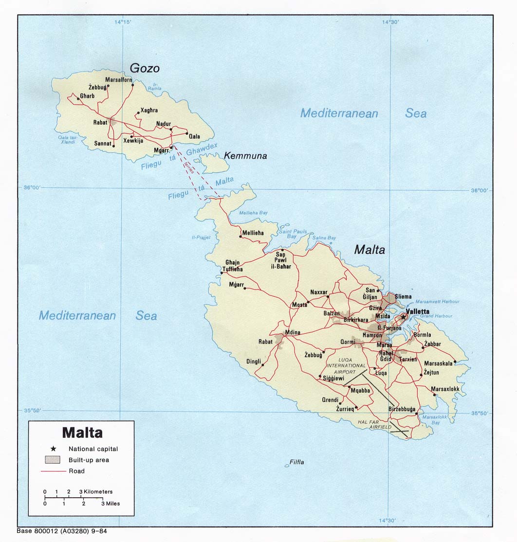
Political map of Malta. Created in 1984 by the Central Intelligence Agency.
This image is in the public domain because it contains materials that originally came from the United States Central Intelligence Agency's World Factbook.
|
 |
http://www.lib.utexas.edu/maps/europe.html
http://www.lib.utexas.edu/maps/europe/malta_pol84.jpg
Historial del fitxer
Cliqueu una data/hora per veure el fitxer tal com era aleshores.
| Data/hora | Miniatura | Dimensions | Usuari/a | Comentari | |
|---|---|---|---|---|---|
| actual | 20:40, 27 des 2006 | | 987 × 1.114 (1,34 Mo) | Electionworld | {{ew|en|Neutrality}} Political map of Malta. Created in 1984 by the Central Intelligence Agency. {{PD-USGov-CIA-WF}} http://www.lib.utexas.edu/maps/europe.html http://www.lib.utexas.edu/maps/europe/malta_pol84.jpg |
Ús del fitxer
La pàgina següent utilitza aquest fitxer:
Ús global del fitxer
Utilització d'aquest fitxer en altres wikis:
- Utilització a af.wikipedia.org
- Utilització a bs.wikipedia.org
- Utilització a de.wikipedia.org
- Utilització a el.wikipedia.org
- Utilització a en.wikipedia.org
- Utilització a fa.wikipedia.org
- Utilització a fr.wikipedia.org
- Utilització a hr.wikipedia.org
- Utilització a hr.wiktionary.org
- Utilització a hu.wikipedia.org
- Utilització a io.wikipedia.org
- Utilització a ja.wikipedia.org
- Utilització a mk.wikipedia.org
- Utilització a nn.wikipedia.org
- Utilització a pl.wiktionary.org
- Utilització a ps.wikipedia.org
- Utilització a ro.wikipedia.org
- Utilització a sco.wikipedia.org
- Utilització a sh.wikipedia.org
- Utilització a sl.wikipedia.org
- Utilització a sr.wikipedia.org
- Utilització a sv.wikivoyage.org
- Utilització a te.wikipedia.org
- Utilització a trv.wikipedia.org
- Utilització a tr.wikipedia.org
- Utilització a uk.wikipedia.org
- Utilització a zh.wikipedia.org