Fitxer:Map of March 2012 attacks in Toulouse and Montauban, and scarlet Vigipirate area, in France.svg

Mida d'aquesta previsualització PNG del fitxer SVG: 632 × 600 píxels. Altres resolucions: 253 × 240 píxels | 506 × 480 píxels | 809 × 768 píxels | 1.079 × 1.024 píxels | 2.158 × 2.048 píxels | 2.000 × 1.898 píxels.
Fitxer original (fitxer SVG, nominalment 2.000 × 1.898 píxels, mida del fitxer: 946 Ko)
| Aquest fitxer i la informació mostrada a continuació provenen del dipòsit multimèdia lliure Wikimedia Commons. |
Resum
| Descripció |
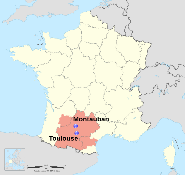
Dansk: Lokalisering af Montauban og Toulouse, to byer i regionen Midi-Pyrénées, Frankrig. I pink, området hvor landets terroralarm, er blevet hævet via Vigipirate. English: Location map of Montauban and Toulouse, two towns in region Midi-Pyrénées, France. In pink, the area covored by the Scarlet Vigipirate level. Français : Carte de localisation de Montauban et Toulouse, deux villes de la région Midi-Pyrénées, France. En rose, la zone couverte par le plan Vigipirate écarlate. |
| Data | (UTC) |
| Font |
This file was derived from: France map Lambert-93 with regions and departments polygons-blank.svg: |
| Autor | |
| Reconeixement (required by the license) | © Sémhur / Wikimedia Commons / |
| SVG genesis | El codi font d’aquest SVG no és vàlid perquè hi 26 han errors. Aquesta imatge vectorial ha estat creada amb Inkscape. |
Toulouse : region:FR-31 43°36′16″N 1°26′38″E / 43.604482°N 1.443962°E Montauban : region:FR-47 44°01′05″N 1°21′21″E / 44.018056°N 1.355833°E
Llicència
Jo, el titular dels drets d'autor d'aquest treball, el public sota les següents llicències:
This file is licensed under the Creative Commons Attribution-Share Alike Attribution-Share Alike 4.0 International, 3.0 Unported, 2.5 Generic, 2.0 Generic and 1.0 Generic license.
- Sou lliure de:
- compartir – copiar, distribuir i comunicar públicament l'obra
- adaptar – fer-ne obres derivades
- Amb les condicions següents:
- reconeixement – Heu de donar la informació adequada sobre l'autor, proporcionar un enllaç a la llicència i indicar si s'han realitzat canvis. Podeu fer-ho amb qualsevol mitjà raonable, però de cap manera no suggereixi que l'autor us dóna suport o aprova l'ús que en feu.
- compartir igual – Si modifiqueu, transformeu, o generareu amb el material, haureu de distribuir les vostres contribucions sota una llicència similar o una de compatible com l'original
| Copyleft: Aquesta és una obra d'art lliure: Podeu redistribuir-la i modificar-la sota els termes de la Llicència d'Art Lliure. Trobareu una còpia d'aquesta llicència al web Copyleft Attitude, així com en altres llocs web. |
Podeu seleccionar la llicència que vulgueu.
Registre original de càrregues
This image is a of the following images:
- File:France map Lambert-93 with regions and departments polygons-blank.svg licensed with Cc-by-sa-3.0,2.5,2.0,1.0, GFDL
- 2009-02-03T18:58:47Z Sting 2000x1898 (1873536 Bytes) == Summary == {{Location|46|15|00|N|02|06|00|E|scale:5000000}} {{Information |Description={{en|Blank map of {{W|France}} in the official Lambert-93 projection, with regions and departments as independent polygons. '
Uploaded with derivativeFX
Historial del fitxer
Cliqueu una data/hora per veure el fitxer tal com era aleshores.
| Data/hora | Miniatura | Dimensions | Usuari/a | Comentari | |
|---|---|---|---|---|---|
| actual | 22:32, 25 març 2012 | | 2.000 × 1.898 (946 Ko) | Pic-Sou | deleting boundaries |
| 10:44, 23 març 2012 |  | 2.000 × 1.898 (1.004 Ko) | Sémhur | bigger text ; vigipirate boundaries | |
| 12:10, 22 març 2012 |  | 2.000 × 1.898 (999 Ko) | Sémhur | == {{int:filedesc}} == {{Information |Description={{Multilingual description |en= Location map of en:Montauban and en:Toulouse, two towns in region Midi-Pyrénées, France. |fr= Carte de localisation de fr:Montauban et [[:fr:Toulouse|... |
Ús del fitxer
La pàgina següent utilitza aquest fitxer:
Ús global del fitxer
Utilització d'aquest fitxer en altres wikis:
- Utilització a ar.wikipedia.org
- Utilització a cs.wikipedia.org
- Utilització a da.wikipedia.org
- Utilització a en.wikipedia.org
- Utilització a es.wikipedia.org
- Utilització a eu.wikipedia.org
- Utilització a fa.wikipedia.org
- Utilització a fi.wikipedia.org
- Utilització a fr.wikipedia.org
- Utilització a he.wikipedia.org
- Utilització a it.wikipedia.org
- Utilització a kk.wikipedia.org
- Utilització a nds.wikipedia.org
- Utilització a nl.wikipedia.org
- Utilització a oc.wikipedia.org
- Utilització a ro.wikipedia.org
- Utilització a ru.wikipedia.org
- Utilització a ta.wikipedia.org
- Utilització a th.wikipedia.org
- Utilització a tr.wikipedia.org
- Utilització a uk.wikipedia.org
- Utilització a vi.wikipedia.org
- Utilització a www.wikidata.org