Fitxer:Map of Oklahoma highlighting Le Flore County.svg

Mida d'aquesta previsualització PNG del fitxer SVG: 800 × 397 píxels. Altres resolucions: 320 × 159 píxels | 640 × 317 píxels | 1.024 × 508 píxels | 1.280 × 634 píxels | 2.560 × 1.269 píxels | 2.209 × 1.095 píxels.
Fitxer original (fitxer SVG, nominalment 2.209 × 1.095 píxels, mida del fitxer: 47 Ko)
| Aquest fitxer i la informació mostrada a continuació provenen del dipòsit multimèdia lliure Wikimedia Commons. |
Resum
| Descripció |
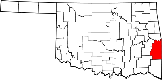
English: This is a locator map showing Le Flore County in Oklahoma. For more information, see Commons:United States county locator maps. |
| Data | |
| Font |
Treball propi: English: The maps use data from nationalatlas.gov, specifically countyp020.tar.gz on the Raw Data Download page. The maps also use state outline data from statesp020.tar.gz. The Florida maps use hydrogm020.tar.gz to display Lake Okeechobee. |
| Autor | David Benbennick |
Llicència
| Jo, el titular del copyright d'aquesta obra, l'allibero al domini públic. Això s'aplica a tot el món. En alguns països això pot no ser legalment possible, en tal cas: Jo faig concessió a tothom del dret d'usar aquesta obra per a qualsevol propòsit, sense cap condició llevat d'aquelles requerides per la llei. |
Historial del fitxer
Cliqueu una data/hora per veure el fitxer tal com era aleshores.
| Data/hora | Miniatura | Dimensions | Usuari/a | Comentari | |
|---|---|---|---|---|---|
| actual | 02:48, 25 juny 2024 | | 2.209 × 1.095 (47 Ko) | Nux | fix rendering (remove clipping) |
| 18:13, 12 feb 2006 |  | 7.730 × 3.832 (57 Ko) | David Benbennick | {{subst:User:Dbenbenn/clm|county=Le Flore County|state=Oklahoma|type=county}} |
Ús del fitxer
Les 19 pàgines següents utilitzen aquest fitxer:
Ús global del fitxer
Utilització d'aquest fitxer en altres wikis:
- Utilització a ar.wikipedia.org
- Utilització a bg.wikipedia.org
- Utilització a bpy.wikipedia.org
- Utilització a cdo.wikipedia.org
- Utilització a ceb.wikipedia.org
- Utilització a cy.wikipedia.org
- Utilització a de.wikipedia.org
- Utilització a en.wikipedia.org
- List of counties in Oklahoma
- LeFlore County, Oklahoma
- Arkoma, Oklahoma
- Bokoshe, Oklahoma
- Cameron, Oklahoma
- Cowlington, Oklahoma
- Fort Coffee, Oklahoma
- Heavener, Oklahoma
- Howe, Oklahoma
- LeFlore, Oklahoma
- Panama, Oklahoma
- Pocola, Oklahoma
- Poteau, Oklahoma
- Rock Island, Oklahoma
- Shady Point, Oklahoma
- Spiro, Oklahoma
- Talihina, Oklahoma
- Wister, Oklahoma
- Fanshawe, Oklahoma
- Skullyville, Oklahoma
- Choctaw Nation of Oklahoma
- Whitesboro, Oklahoma
- Hodgen, Oklahoma
- Monroe, Oklahoma
- Spiro Mounds
- Trahern's Station
- Walker's Station
- Template:LeFlore County, Oklahoma
- User:Nyttend/County templates/OK
- National Register of Historic Places listings in LeFlore County, Oklahoma
- Williams School (Cameron, Oklahoma)
- Page, Oklahoma
- Honobia, Oklahoma
- Muse, Oklahoma
Vegeu més usos globals d'aquest fitxer.