Fitxer:Map of Stark County Ohio Highlighting Massillon City.png
No hi ha cap versió amb una resolució més gran.
Map_of_Stark_County_Ohio_Highlighting_Massillon_City.png (624 × 535 píxels, mida del fitxer: 33 Ko, tipus MIME: image/png)
| Aquest fitxer i la informació mostrada a continuació provenen del dipòsit multimèdia lliure Wikimedia Commons. |
| Descripció |
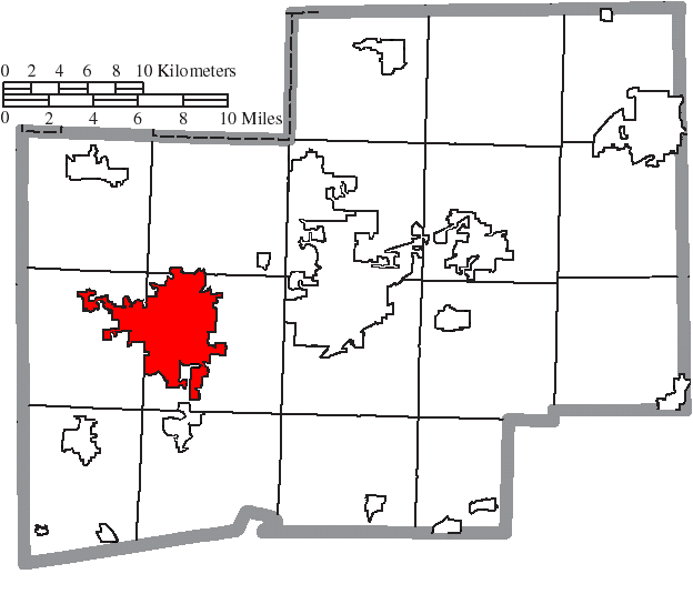
English: Map of the municipal and township boundaries of Stark County, Ohio, United States, as of the 2000 census, with the location of the city of Massillon highlighted. Township borders are shown only in unincorporated areas in order to differentiate incorporated and unincorporated areas more clearly. |
| Data | |
| Font | File:Map of Stark County Ohio With Municipal and Township Labels.PNG |
| Autor | Ruhrfisch and Nyttend |
| Permís (Com reutilitzar aquest fitxer) |
Aquest fitxer està subjecte a la llicència de Creative Commons Reconeixement i Compartir Igual 3.0 No adaptada.
|
Historial del fitxer
Cliqueu una data/hora per veure el fitxer tal com era aleshores.
| Data/hora | Miniatura | Dimensions | Usuari/a | Comentari | |
|---|---|---|---|---|---|
| actual | 23:29, 18 ago 2015 | | 624 × 535 (33 Ko) | Nyttend | {{Information |Description={{en|Map of the municipal and township boundaries of {{w|Stark County, Ohio|Stark County}}, {{w|Ohio}}, {{w|United States}}, as of the 2000 census, with the location of the city of {{w|Massillon, Ohio|Massillon}} highlighted.... |
Ús del fitxer
La pàgina següent utilitza aquest fitxer:
Ús global del fitxer
Utilització d'aquest fitxer en altres wikis:
- Utilització a ar.wikipedia.org
- Utilització a arz.wikipedia.org
- Utilització a azb.wikipedia.org
- Utilització a cy.wikipedia.org
- Utilització a el.wikipedia.org
- Utilització a es.wikipedia.org
- Utilització a eu.wikipedia.org
- Utilització a fr.wikipedia.org
- Utilització a ht.wikipedia.org
- Utilització a tt.wikipedia.org
- Utilització a vo.wikipedia.org
- Utilització a www.wikidata.org
- Utilització a zh.wikipedia.org