Fitxer:Minamata Bay 1974.jpg

Mida d'aquesta previsualització: 544 × 599 píxels. Altres resolucions: 218 × 240 píxels | 436 × 480 píxels | 697 × 768 píxels | 929 × 1.024 píxels | 1.859 × 2.048 píxels | 3.183 × 3.507 píxels.
Fitxer original (3.183 × 3.507 píxels, mida del fitxer: 1,38 Mo, tipus MIME: image/jpeg)
| Aquest fitxer i la informació mostrada a continuació provenen del dipòsit multimèdia lliure Wikimedia Commons. |
Resum
| Descripció |
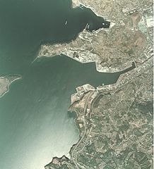
English: Minamata Bay 1974
日本語: 1974年の水俣湾。上が北側 |
| Data | |
| Font | 国土画像情報閲覧システム |
| Autor | 日本国運輸省 |
Llicència

|
El titular dels drets d'autor d'aquest arxiu, the Ministry of Land, Infrastructure, Transport and Tourism of Japan, permet que qualsevol pugui usar-lo per a qualsevol propòsit, sempre que el titular dels drets d'autor sigui reconegut correctament. La redistribució, les obres derivades, l'ús comercial, i qualsevol altre ús està permès. |
Reconeixement:
Copyright © National Land Image Information (Color Aerial Photographs), Ministry of Land, Infrastructure, Transport and Tourism
|
 |
This image is copyrighted by the Ministry of Land, Infrastructure, Transport and Tourism of Japan. For terms of use, see the stipulation to use of National Land Information (in Japanese) and message from MLIT (in Japanese and English). When you display this image on an article, include the following phrase in the description: "Made based on National Land Image Information (Color Aerial Photographs), Ministry of Land, Infrastructure, Transport and Tourism".
|
Historial del fitxer
Cliqueu una data/hora per veure el fitxer tal com era aleshores.
| Data/hora | Miniatura | Dimensions | Usuari/a | Comentari | |
|---|---|---|---|---|---|
| actual | 18:07, 30 gen 2014 | | 3.183 × 3.507 (1,38 Mo) | Cropbot | upload cropped version, operated by User:Andy king50. Summary: cropped |
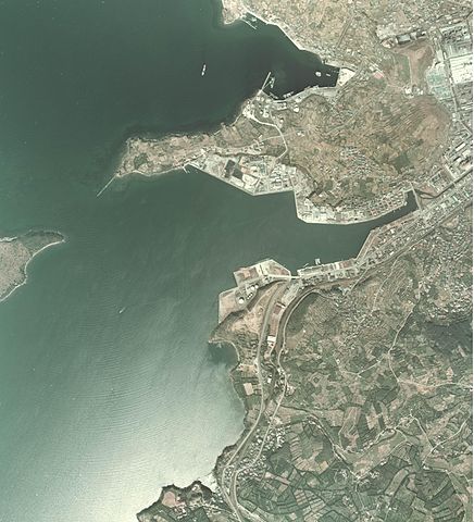
| 13:19, 15 gen 2011 |  | 3.861 × 3.507 (1,37 Mo) | Hyolee2 | {{Information |Description={{en|1=Minamata Bay 1974}} {{ja|1=1974年の水俣湾}} |Source=国土画像情報閲覧システム |Author=日本国運輸省 |Date=1974 |Permission= |other_versions= }} |
Ús del fitxer
La pàgina següent utilitza aquest fitxer:
Ús global del fitxer
Utilització d'aquest fitxer en altres wikis:
- Utilització a ar.wikipedia.org
- Utilització a arz.wikipedia.org
- Utilització a ceb.wikipedia.org
- Utilització a ce.wikipedia.org
- Utilització a cs.wikipedia.org
- Utilització a de.wikivoyage.org
- Utilització a en.wikivoyage.org
- Utilització a eo.wikipedia.org
- Utilització a es.wikipedia.org
- Utilització a es.wikivoyage.org
- Utilització a eu.wikipedia.org
- Utilització a fr.wikipedia.org
- Utilització a gl.wikipedia.org
- Utilització a hr.wikipedia.org
- Utilització a it.wikipedia.org
- Utilització a ja.wikipedia.org
- Utilització a ja.wikivoyage.org
- Utilització a mzn.wikipedia.org
- Utilització a pt.wikipedia.org
- Utilització a ro.wikipedia.org
- Utilització a sh.wikipedia.org
- Utilització a tt.wikipedia.org
- Utilització a vi.wikipedia.org
- Utilització a www.wikidata.org