Fitxer:NYCS map 3.svg

Mida d'aquesta previsualització PNG del fitxer SVG: 490 × 599 píxels. Altres resolucions: 196 × 240 píxels | 393 × 480 píxels | 628 × 768 píxels | 838 × 1.024 píxels | 1.676 × 2.048 píxels | 648 × 792 píxels.
Fitxer original (fitxer SVG, nominalment 648 × 792 píxels, mida del fitxer: 417 Ko)
| Aquest fitxer i la informació mostrada a continuació provenen del dipòsit multimèdia lliure Wikimedia Commons. |
Resum
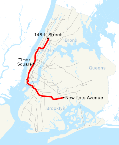
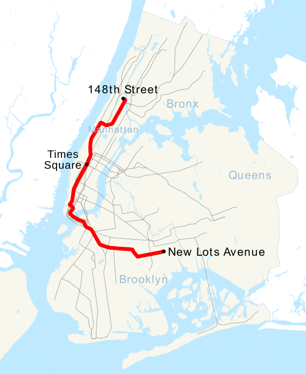
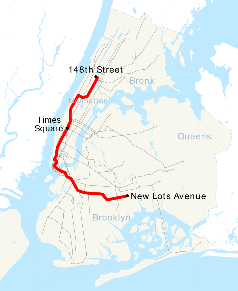
| Descripció | This is a map showing the New York City Subway's 3 service. It was created with TIGER/Line GIS data (water and boundaries) and my own data (subway lines and stations, traced on TIGER/Line road data). If you would like a copy of the subway data, email me. |
| Data | 30 d'abril de 2007 (original upload date) |
| Font | No machine-readable source provided. Own work assumed (based on copyright claims). |
| Autor | No machine-readable author provided. NE2 assumed (based on copyright claims). |
Llicència
| Jo, el titular del copyright d'aquesta obra, l'allibero al domini públic. Això s'aplica a tot el món. En alguns països això pot no ser legalment possible, en tal cas: Jo faig concessió a tothom del dret d'usar aquesta obra per a qualsevol propòsit, sense cap condició llevat d'aquelles requerides per la llei. |
Historial del fitxer
Cliqueu una data/hora per veure el fitxer tal com era aleshores.
| Data/hora | Miniatura | Dimensions | Usuari/a | Comentari | |
|---|---|---|---|---|---|
| actual | 18:28, 23 juny 2018 | | 648 × 792 (417 Ko) | LRG5784 | Reverted to version as of 22:44, 20 March 2016 (UTC) End of weekend changes |
| 21:03, 26 juny 2017 |  | 648 × 792 (442 Ko) | PrecipiceofDuck | Updated with Hurricane Sandy Fix&Fortify Clark St Tunnel repair work | |
| 00:44, 21 març 2016 |  | 648 × 792 (417 Ko) | PrecipiceofDuck | Map updated to show Times Square as late night terminal. | |
| 23:50, 18 març 2016 |  | 648 × 792 (415 Ko) | PrecipiceofDuck | Map updated to include 7 line extension. | |
| 23:50, 4 nov 2011 |  | 648 × 792 (343 Ko) | Train2104 | Text to path | |
| 01:54, 1 maig 2007 |  | 648 × 792 (391 Ko) | NE2 | == Summary == This is a map showing the New York City Subway's 3 service. It was created with TIGER/Line GIS data (water and boundaries) and my own data (subway lines and stations, traced on TIGER/Line road data). If you would like a copy of the subway da |
Ús del fitxer
La pàgina següent utilitza aquest fitxer:
Ús global del fitxer
Utilització d'aquest fitxer en altres wikis:
- Utilització a de.wikipedia.org
- Utilització a en.wikipedia.org
- Utilització a es.wikipedia.org
- Utilització a fi.wikipedia.org
- Utilització a fr.wikipedia.org
- Utilització a he.wikipedia.org
- Utilització a ja.wikipedia.org
- Utilització a ko.wikipedia.org
- Utilització a lmo.wikipedia.org
- Utilització a nl.wikipedia.org
- Utilització a no.wikipedia.org
- Utilització a pl.wikipedia.org
- Utilització a pt.wikipedia.org
- Utilització a ru.wikipedia.org
- Utilització a www.wikidata.org
- Utilització a zh.wikipedia.org