Fitxer:Nationalpark hohe tauern.png
Mida d'aquesta previsualització: 800 × 549 píxels. Altres resolucions: 320 × 219 píxels | 640 × 439 píxels | 1.024 × 702 píxels | 1.280 × 878 píxels | 2.412 × 1.654 píxels.
Fitxer original (2.412 × 1.654 píxels, mida del fitxer: 460 Ko, tipus MIME: image/png)
| Aquest fitxer i la informació mostrada a continuació provenen del dipòsit multimèdia lliure Wikimedia Commons. |
Resum
| Descripció |
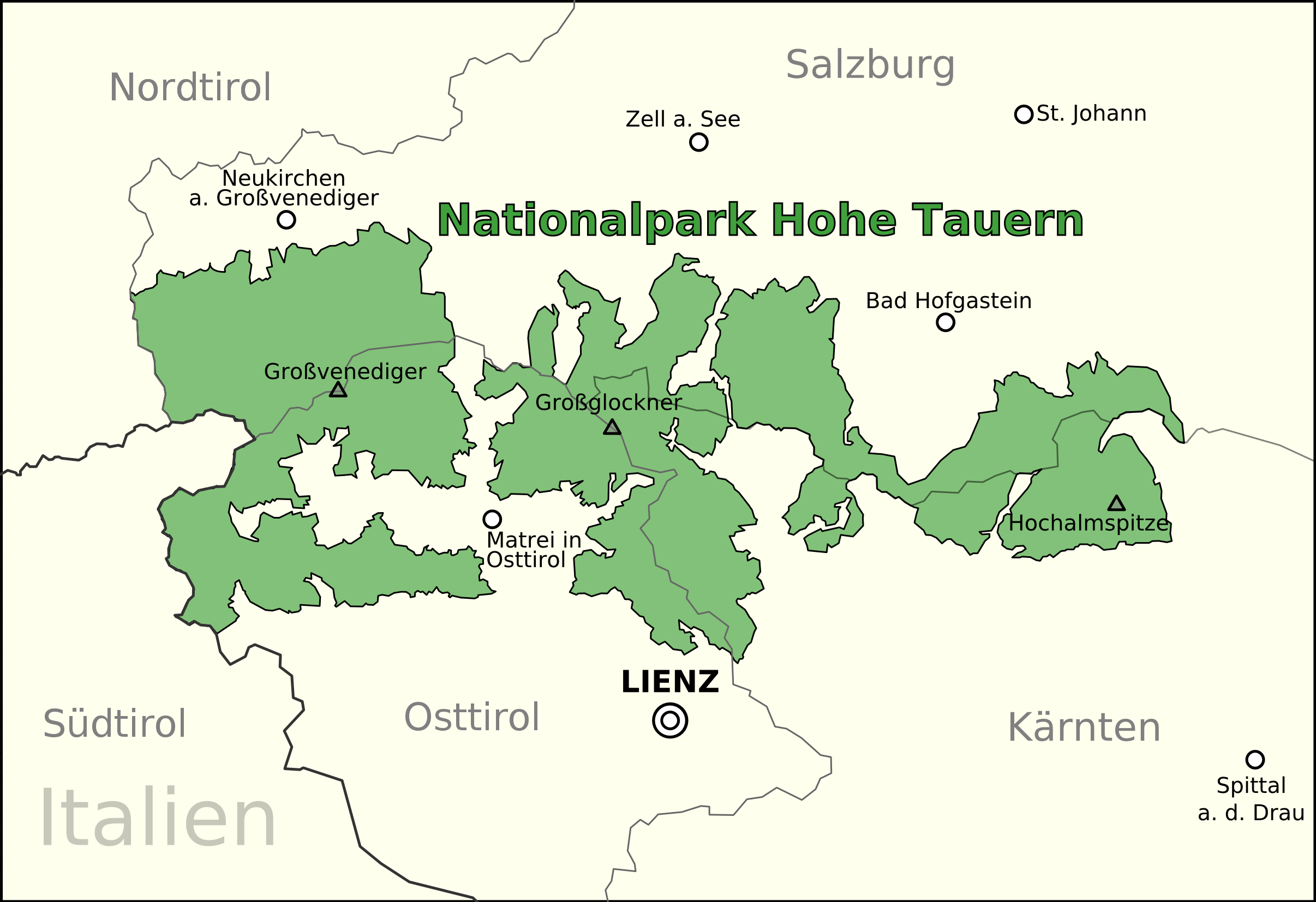
English: Map of the Hohe Tauern Nationalpark in Austria
Deutsch: Karte des Nationalparks Hohe Tauern in Österreich |
| Data | |
| Font | Own work by uploader, based on [1] |
| Autor | Anitagraser |
![[1]](http://www.hohetauern.at/dmdocuments/schutzgebietsverbund.jpg)
Llicència
| Jo, el titular del copyright d'aquesta obra, l'allibero al domini públic. Això s'aplica a tot el món. En alguns països això pot no ser legalment possible, en tal cas: Jo faig concessió a tothom del dret d'usar aquesta obra per a qualsevol propòsit, sense cap condició llevat d'aquelles requerides per la llei. |
Historial del fitxer
Cliqueu una data/hora per veure el fitxer tal com era aleshores.
| Data/hora | Miniatura | Dimensions | Usuari/a | Comentari | |
|---|---|---|---|---|---|
| actual | 21:39, 23 ago 2009 | | 2.412 × 1.654 (460 Ko) | Imalipusram | three different Tirols |
| 13:18, 7 des 2008 |  | 2.412 × 1.654 (451 Ko) | Anitagraser | {{Information |Description={{en|1=Map of the Hohe Tauern Nationalpark in Austria}} {{de|1=Karte des Nationalparks Hohe Tauern in Österreich}} |Source=Own work by uploader, based on [http://www.hohetauern.at/dmdocuments/schutzgebietsverbund.jpg] |Date=200 | |
| 21:25, 30 ago 2008 |  | 2.412 × 1.655 (448 Ko) | Anitagraser | {{Information |Description={{en|1=Map of the Hohe Tauern Nationalpark in Austria}} {{de|1=Karte des Nationalparks Hohe Tauern in Österreich}} |Source=Own work by uploader, based on [http://www.hohetauern.at/dmdocuments/schutzgebietsverbund.jpg] |Author=[ |
Ús del fitxer
La pàgina següent utilitza aquest fitxer:
Ús global del fitxer
Utilització d'aquest fitxer en altres wikis:
- Utilització a bg.wikipedia.org
- Utilització a cs.wikipedia.org
- Utilització a de.wikipedia.org
- Utilització a de.wikivoyage.org
- Utilització a en.wikipedia.org
- Utilització a en.wikivoyage.org
- Utilització a es.wikipedia.org
- Utilització a fi.wikipedia.org
- Utilització a he.wikipedia.org
- Utilització a he.wikivoyage.org
- Utilització a hr.wikipedia.org
- Utilització a hu.wikipedia.org
- Utilització a hy.wikipedia.org
- Utilització a it.wikipedia.org
- Utilització a ja.wikipedia.org
- Utilització a mk.wikipedia.org
- Utilització a nl.wikipedia.org
- Utilització a pl.wikipedia.org
- Utilització a ro.wikipedia.org
- Utilització a sk.wikipedia.org
- Utilització a sl.wikipedia.org
- Utilització a sv.wikipedia.org
- Utilització a uk.wikipedia.org
- Utilització a www.wikidata.org
- Utilització a zh.wikipedia.org