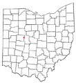
Fitxer:OHMap-doton-West Mansfield.png
OHMap-doton-West_Mansfield.png (274 × 300 píxels, mida del fitxer: 10 Ko, tipus MIME: image/png)
Historial del fitxer
Cliqueu una data/hora per veure el fitxer tal com era aleshores.
| Data/hora | Miniatura | Dimensions | Usuari/a | Comentari | |
|---|---|---|---|---|---|
| actual | 23:47, 9 jul 2007 |  | 274 × 300 (10 Ko) | SieBot | {{Information |Description=<br>Adapted from Wikipedia's OH county maps by Catbar. |Source=Originally from [http://en.wikipedia.org en.wikipedia]; description page is/was [http://en.wikipedia.org/w/index.php?title=Image%3AOHMap-doton-West_Mansfield.png he |
Ús del fitxer
La pàgina següent utilitza aquest fitxer:
Ús global del fitxer
Utilització d'aquest fitxer en altres wikis:
- Utilització a ar.wikipedia.org
- Utilització a azb.wikipedia.org
- Utilització a cy.wikipedia.org
- Utilització a en.wikipedia.org
- Utilització a eu.wikipedia.org
- Utilització a fr.wikipedia.org
- Utilització a ht.wikipedia.org
- Utilització a sh.wikipedia.org
- Utilització a sr.wikipedia.org
- Utilització a vi.wikipedia.org
- Utilització a www.wikidata.org


