Fitxer:Polyconic projection 118.png
No hi ha cap versió amb una resolució més gran.
Polyconic_projection_118.png (118 × 91 píxels, mida del fitxer: 13 Ko, tipus MIME: image/png)
| Aquest fitxer i la informació mostrada a continuació provenen del dipòsit multimèdia lliure Wikimedia Commons. |
Resum
| Descripció |
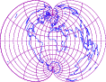
English: world map in polyconic projection
with 15-degree grids, blue continents and purple graticule on white background |
| Data | |
| Font |
drawn by myself with program http://apollo.ersc.wisc.edu/finch/zz2007/cartoplus/cartoplus.tgz using freely available materials especially DCL http://www.gfd-dennou.org/arch/dcl |
| Autor | prasinos |
Llicència
| Jo, el titular del copyright d'aquesta obra, l'allibero al domini públic. Això s'aplica a tot el món. En alguns països això pot no ser legalment possible, en tal cas: Jo faig concessió a tothom del dret d'usar aquesta obra per a qualsevol propòsit, sense cap condició llevat d'aquelles requerides per la llei. |
Historial del fitxer
Cliqueu una data/hora per veure el fitxer tal com era aleshores.
| Data/hora | Miniatura | Dimensions | Usuari/a | Comentari | |
|---|---|---|---|---|---|
| actual | 21:21, 18 nov 2007 | | 118 × 91 (13 Ko) | Prasinos | {{Information |Description=world map in polyconic projection with 15-degree grids, blue continents and purple grauticle on white background |Source=drawn by myself with program http://apollo.ersc.wisc.edu/finch/zz2007/cartoplus/cartoplus.tgz using freely |
Ús del fitxer
La pàgina següent utilitza aquest fitxer: