Fitxer:Principality of Orange (1633).png
Mida d'aquesta previsualització: 800 × 560 píxels. Altres resolucions: 320 × 224 píxels | 640 × 448 píxels | 1.024 × 716 píxels | 1.280 × 895 píxels | 2.276 × 1.592 píxels.
Fitxer original (2.276 × 1.592 píxels, mida del fitxer: 9,11 Mo, tipus MIME: image/png)
| Aquest fitxer i la informació mostrada a continuació provenen del dipòsit multimèdia lliure Wikimedia Commons. |
.png?uselang=ca)
Resum
| Descripció |
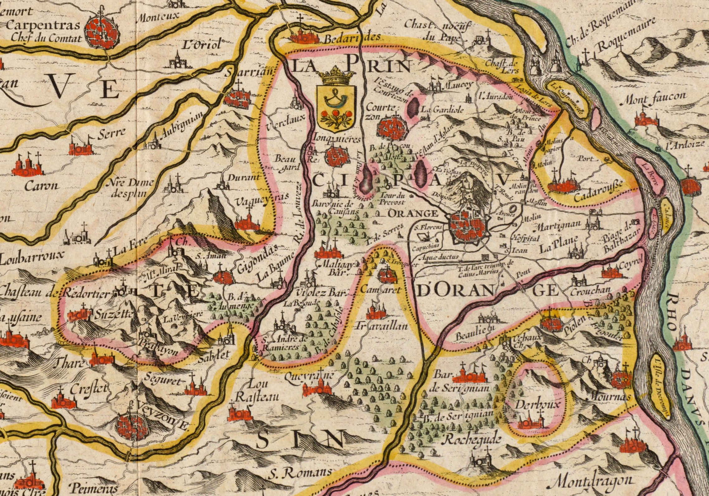
English: Territory of the Principality of Orange. Cropped from a Jan Jansson map from 1633 titled La Principauté d'Orange et comtat de Venaissin. On this map, the south is at the top and the north at the bottom, which explains why the Rhone River is on the right and the city of Carpentras on the left. |
| Data | |
| Font | Digital Commonwealth Massachusetts Collection Online |
| Autor | Jan Jansson (1588-1664) |
Llicència
|
Aquest material està en domini públic als Estats Units i als altres països on el dret d'autor s'estén per 100 anys (o menys) després de la mort de l'autor. | |
| Aquest fitxer està identificat com a lliure de restriccions conegudes sota la llei de drets d'autor, inclosos els drets veïns. | |
Historial del fitxer
Cliqueu una data/hora per veure el fitxer tal com era aleshores.
| Data/hora | Miniatura | Dimensions | Usuari/a | Comentari | |
|---|---|---|---|---|---|
| actual | 10:51, 14 set 2019 | | 2.276 × 1.592 (9,11 Mo) | Jfblanc | Updrate cropping including the whole Derboux enclave area. |
| 21:20, 26 nov 2016 |  | 1.226 × 687 (2,46 Mo) | Lubiesque | User created page with UploadWizard |
Ús del fitxer
No hi ha pàgines que utilitzin aquest fitxer.
Ús global del fitxer
Utilització d'aquest fitxer en altres wikis:
- Utilització a azb.wikipedia.org
- Utilització a en.wikipedia.org
- Utilització a fy.wikipedia.org
- Utilització a it.wikipedia.org
- Utilització a ko.wikipedia.org
- Utilització a vi.wikipedia.org
.png)