Fitxer:South India Map 1794.jpg
Mida d'aquesta previsualització: 442 × 599 píxels. Altres resolucions: 177 × 240 píxels | 354 × 480 píxels | 567 × 768 píxels | 755 × 1.024 píxels | 1.511 × 2.048 píxels | 3.400 × 4.608 píxels.
Fitxer original (3.400 × 4.608 píxels, mida del fitxer: 2,59 Mo, tipus MIME: image/jpeg)
| Aquest fitxer i la informació mostrada a continuació provenen del dipòsit multimèdia lliure Wikimedia Commons. |
Resum
| Descripció |
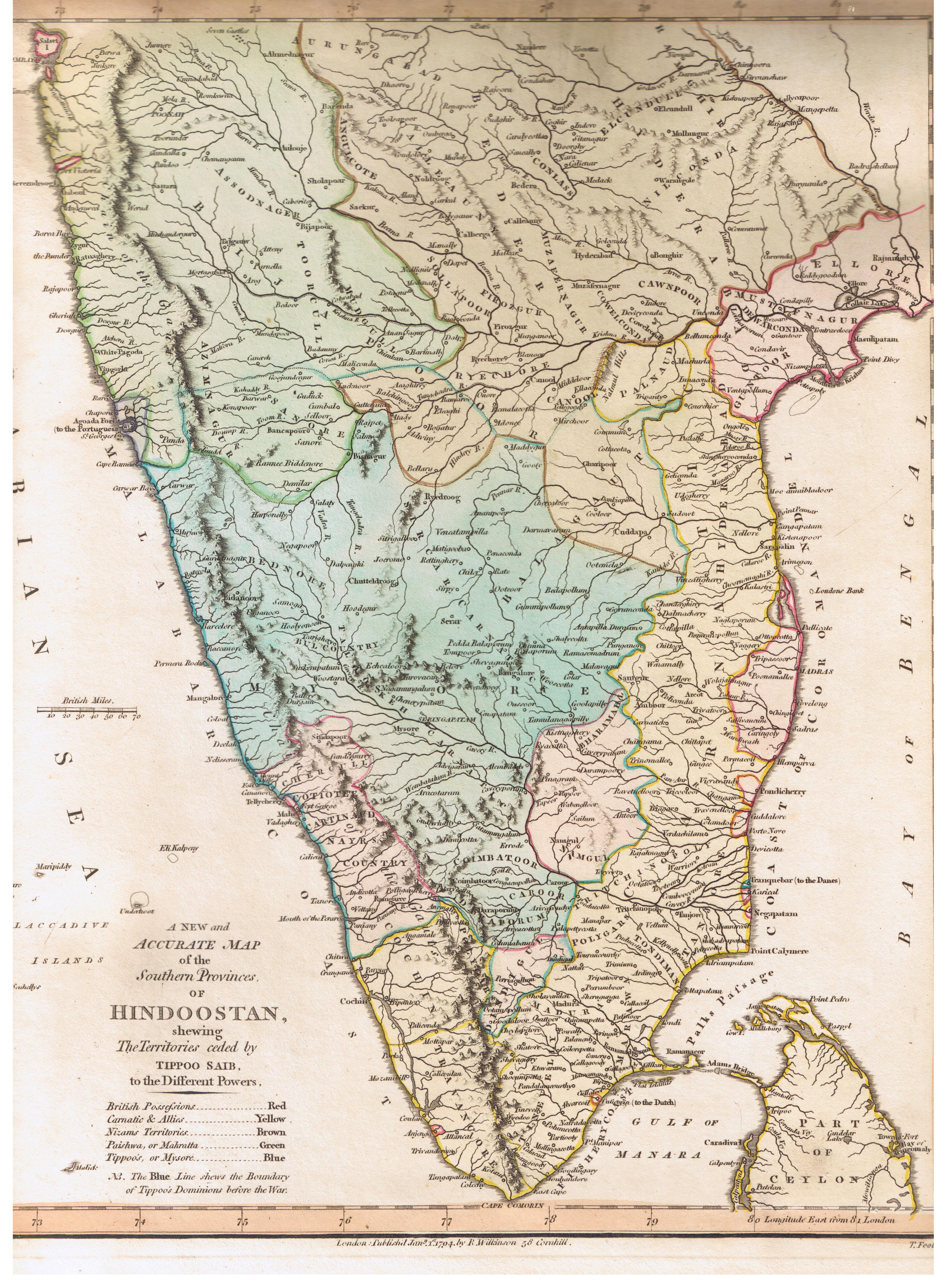
English: This map describes the political state of the Indian subcontinent after the Third Anglo-Mysore War.
Map is captioned as follows: A New and Accurate Map of the Southern Provinces of Hindoostan, shewing The Territories ceded by TIPOO SAHIB to the Different Powers |
|||||||||
| Data | ||||||||||
| Font | Published by R. Wilkinson, 58 Cornhill, London | |||||||||
| Creador |
T. Foot Sculp |
|||||||||
| Permís (Com reutilitzar aquest fitxer) |
public domain because of age | |||||||||
| Geotemporal data | ||||||||||
| Bounding box |
|
|||||||||
| Georeferencing | ||||||||||
| Altres versions |
|
|||||||||

Llicència
|
Aquest material està en domini públic als Estats Units i als altres països on el dret d'autor s'estén per 100 anys (o menys) després de la mort de l'autor. | |
| Aquest fitxer està identificat com a lliure de restriccions conegudes sota la llei de drets d'autor, inclosos els drets veïns. | |
Historial del fitxer
Cliqueu una data/hora per veure el fitxer tal com era aleshores.
| Data/hora | Miniatura | Dimensions | Usuari/a | Comentari | |
|---|---|---|---|---|---|
| actual | 18:57, 10 ago 2007 | | 3.400 × 4.608 (2,59 Mo) | Marcus334 | {{Information |Description= A New and Accurate Map of the Southern Provinces of Hindoostan, shewing The Territories ceded by TIPOO SAHIB to the Different Powers |Source= Published by R. Wilkinson, 58 Cornhill, London |Date= Jan 1, 1794 |Author= T. Foot Sc |
Ús del fitxer
La pàgina següent utilitza aquest fitxer:
Ús global del fitxer
Utilització d'aquest fitxer en altres wikis:
- Utilització a ar.wikipedia.org
- Utilització a en.wikipedia.org
- Utilització a ta.wikipedia.org
- Utilització a vi.wikipedia.org