Fitxer:Strathoykel at Tuiteam Tarbhach.jpg

Mida d'aquesta previsualització: 800 × 598 píxels. Altres resolucions: 320 × 239 píxels | 640 × 479 píxels | 1.024 × 766 píxels | 1.280 × 958 píxels | 2.560 × 1.915 píxels | 2.866 × 2.144 píxels.
Fitxer original (2.866 × 2.144 píxels, mida del fitxer: 2,66 Mo, tipus MIME: image/jpeg)
| Aquest fitxer i la informació mostrada a continuació provenen del dipòsit multimèdia lliure Wikimedia Commons. |
Resum
| Descripció |
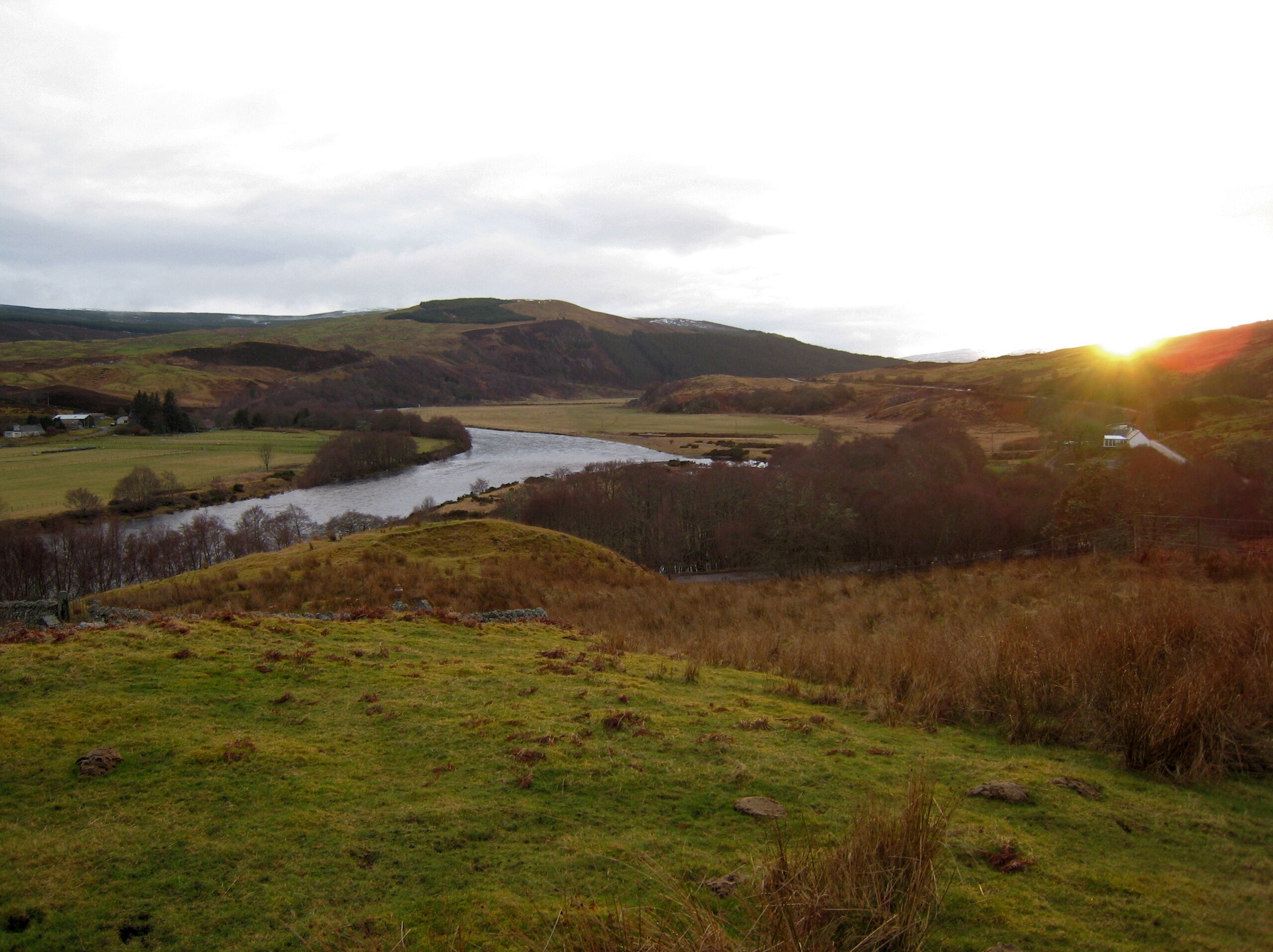
English: View of Strathoykel in northern Scotland looking west (upstream) from Tutim cemetery at sunset. The cemetery wall is in the foreground, Brae farm on the left of the photo, and Tuiteam house on the right. The mouth of the Tutim Burn can be seen entering the River Oykel roughly level with Tuiteam house. The hill is Ben Chreagach. The site is notable for the en:Battle of Tuiteam Tarbhach which took place around Tuiteam house in about 1406. |
| Data | |
| Font | Treball propi |
| Autor | Le Deluge |
| Posició de la càmera | | Aquesta i altres imatges properes a: OpenStreetMap |
|---|
Llicència
Jo, el titular dels drets d'autor d'aquest treball, el public sota la següent llicència:
Aquest fitxer està subjecte a la llicència de Creative Commons Reconeixement i Compartir Igual 3.0 No adaptada.
- Sou lliure de:
- compartir – copiar, distribuir i comunicar públicament l'obra
- adaptar – fer-ne obres derivades
- Amb les condicions següents:
- reconeixement – Heu de donar la informació adequada sobre l'autor, proporcionar un enllaç a la llicència i indicar si s'han realitzat canvis. Podeu fer-ho amb qualsevol mitjà raonable, però de cap manera no suggereixi que l'autor us dóna suport o aprova l'ús que en feu.
- compartir igual – Si modifiqueu, transformeu, o generareu amb el material, haureu de distribuir les vostres contribucions sota una llicència similar o una de compatible com l'original
Historial del fitxer
Cliqueu una data/hora per veure el fitxer tal com era aleshores.
| Data/hora | Miniatura | Dimensions | Usuari/a | Comentari | |
|---|---|---|---|---|---|
| actual | 05:31, 15 març 2009 | | 2.866 × 2.144 (2,66 Mo) | Le Deluge | {{Information |Description={{en|1=View of Strathoykel in northern Scotland looking west (upstream) from Tutim cemetery at sunset. The cemetery wall is in the foreground, Brae farm on the left of the photo, and Tuiteam house on the right. The mouth of the |
Ús del fitxer
La pàgina següent utilitza aquest fitxer:
Ús global del fitxer
Utilització d'aquest fitxer en altres wikis:
- Utilització a ceb.wikipedia.org
- Utilització a en.wikipedia.org
- Utilització a gd.wikipedia.org
- Utilització a www.wikidata.org