Fitxer:UE Soils.png

Mida d'aquesta previsualització: 800 × 575 píxels. Altres resolucions: 320 × 230 píxels | 640 × 460 píxels | 1.024 × 736 píxels | 1.280 × 920 píxels | 2.560 × 1.841 píxels | 2.872 × 2.065 píxels.
Fitxer original (2.872 × 2.065 píxels, mida del fitxer: 364 Ko, tipus MIME: image/png)
| Aquest fitxer i la informació mostrada a continuació provenen del dipòsit multimèdia lliure Wikimedia Commons. |
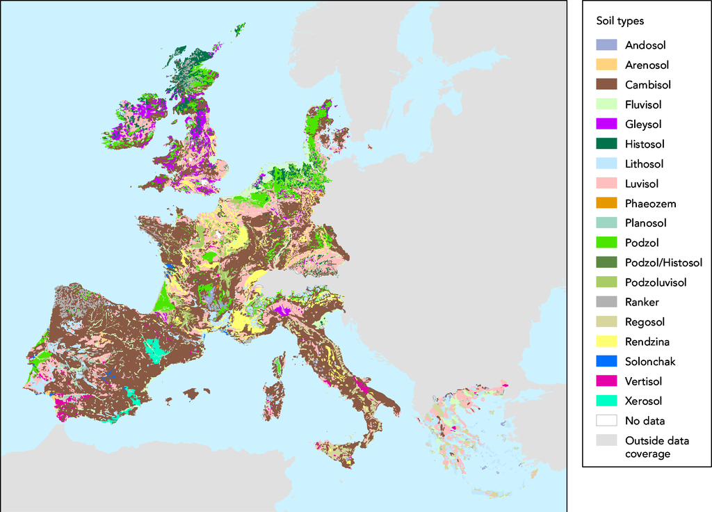
- Source :
- The map was made on data in GISCO delivery 12-2002 which was slightly revised compared to the available dataset (GISCO delivery 09-2000).
- Date:
- 05/03/2003
- Keyword(s):
- desertification,soil,geographic,DISMED Natlan.
- Type:
- Map
- Technical producer:
- European Environment Agency
- http://www.eea.eu.int archive copy at the Wayback Machine
- View the full description here:
This image is in the public domain because it is extracted from the European Environment Agency Website, whose material is in the public domain unless otherwise stated (see the copyright notice). Online access: www.eea.eu.int
This is valid despite the copyright notice at the bottom of each page, see this confirmation e-mail. | |
Historial del fitxer
Cliqueu una data/hora per veure el fitxer tal com era aleshores.
| Data/hora | Miniatura | Dimensions | Usuari/a | Comentari | |
|---|---|---|---|---|---|
| actual | 17:44, 27 nov 2005 | | 2.872 × 2.065 (364 Ko) | Tvpm | *Source : ::The map was made on data in GISCO delivery 12-2002 which was slightly revised compared to the available dataset (GISCO delivery 09-2000). *Date: ::05/03/2003 *Keyword(s): ::desertification,soil,geographic,DISMED Natlan. *Type: ::Map *Technical |
Ús del fitxer
La pàgina següent utilitza aquest fitxer:
Ús global del fitxer
Utilització d'aquest fitxer en altres wikis:
- Utilització a de.wikipedia.org
- Utilització a et.wikipedia.org
- Utilització a fr.wikipedia.org
- Utilització a nl.wikipedia.org