Fitxer:USA Territorial Growth 1820 alt.jpg

Mida d'aquesta previsualització: 800 × 369 píxels. Altres resolucions: 320 × 148 píxels | 640 × 295 píxels | 1.192 × 550 píxels.
Fitxer original (1.192 × 550 píxels, mida del fitxer: 131 Ko, tipus MIME: image/jpeg)
| Aquest fitxer i la informació mostrada a continuació provenen del dipòsit multimèdia lliure Wikimedia Commons. |
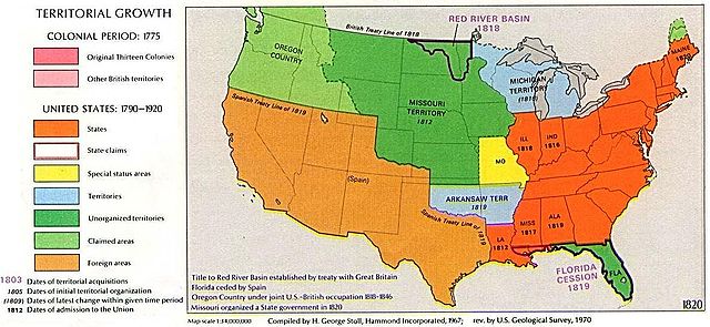
1970 USGS map
Aquesta imatge és de domini públic, ja que conté materials que originalment van venir del Servei Geològic dels Estats Units d'Amèrica, una agència del Departament de l'Interior dels Estats Units. Per a obtenir més informació, consulti la política oficial de drets de l'USGS.
|
Other versions: 
Visually reorganized by Beyond My Ken (talk) 22:01, 18 April 2010 (UTC)
| US growth maps |
| Animated: large · small |
| Years |
| 1775 · 1790 · 1800 · 1810 · 1820 · 1830 · 1840 · 1850 · 1860 · 1870 · 1880 · 1900 · 1920 |

|
Aquesta imatge (de tipus historical map) s'hauria de tornar a crear utilitzant gràfics vectorials com ara un fitxer SVG. Això té diversos avantatges; en trobareu més informació a Commons:Media for cleanup. Si ja disposeu d'una versió d'aquesta imatge en format SVG, us preguem que la pengeu; després, reemplaceu aquesta plantilla amb la plantilla {{Vector version available|nom nou de la imatge.svg}} en aquesta imatge.
|


Historial del fitxer
Cliqueu una data/hora per veure el fitxer tal com era aleshores.
| Data/hora | Miniatura | Dimensions | Usuari/a | Comentari | |
|---|---|---|---|---|---|
| actual | 00:02, 19 abr 2010 | | 1.192 × 550 (131 Ko) | Beyond My Ken | First upload failed |
| 00:01, 19 abr 2010 |  | 1.192 × 550 (131 Ko) | Beyond My Ken | 1970 USGS map {{PD-USGov-USGS}} Other versions: 150px Visually reorganized by ~~~~ {{US growth maps}} {{svg|map}} Category:Territorial Growth Maps of the United States |
Ús del fitxer
No hi ha pàgines que utilitzin aquest fitxer.
Ús global del fitxer
Utilització d'aquest fitxer en altres wikis:
- Utilització a ang.wikipedia.org
- Utilització a ar.wikipedia.org
- Utilització a da.wikipedia.org
- Utilització a en.wikipedia.org
- Utilització a es.wikipedia.org
- Utilització a eu.wikipedia.org
- Utilització a fr.wikipedia.org
- Utilització a he.wikipedia.org
- Utilització a id.wikipedia.org
- Utilització a it.wikipedia.org
- Utilització a ko.wikipedia.org
- Utilització a ms.wikipedia.org
- Utilització a no.wikipedia.org
- Utilització a sv.wikipedia.org
- Utilització a zh.wikipedia.org