Fitxer:United Kingdom United States Locator.svg

Mida d'aquesta previsualització PNG del fitxer SVG: 800 × 353 píxels. Altres resolucions: 320 × 141 píxels | 640 × 283 píxels | 1.024 × 452 píxels | 1.280 × 565 píxels | 2.560 × 1.130 píxels | 940 × 415 píxels.
Fitxer original (fitxer SVG, nominalment 940 × 415 píxels, mida del fitxer: 2,56 Mo)
| Aquest fitxer i la informació mostrada a continuació provenen del dipòsit multimèdia lliure Wikimedia Commons. |
Resum
| Descripció |
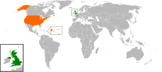
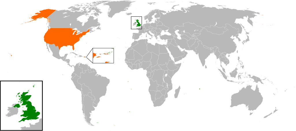
English: Map of the world showing the location of the United Kingdom and the United States of America. |
| Data | |
| Font | Treball propi |
| Autor | Jolly Janner |
Llicència
| Jo, el titular del copyright d'aquesta obra, l'allibero al domini públic. Això s'aplica a tot el món. En alguns països això pot no ser legalment possible, en tal cas: Jo faig concessió a tothom del dret d'usar aquesta obra per a qualsevol propòsit, sense cap condició llevat d'aquelles requerides per la llei. |
Historial del fitxer
Cliqueu una data/hora per veure el fitxer tal com era aleshores.
| Data/hora | Miniatura | Dimensions | Usuari/a | Comentari | |
|---|---|---|---|---|---|
| actual | 18:00, 20 març 2017 | | 940 × 415 (2,56 Mo) | RaviC | add dependencies, inset map for Virgin Islands region where both states share a maritime border |
| 04:43, 24 des 2016 |  | 940 × 415 (1,79 Mo) | BurritoBazooka | put all Faroe islands except Suðuroy region behind black border of UK box. Make two boxes (transparent group rectangle and white bg rectangle) same stroke thickness. | |
| 02:43, 24 des 2016 |  | 940 × 415 (1,79 Mo) | BurritoBazooka | add France and Faroe Islands to UK box by re-cutting it from its place on the map (b/c why should ROI, another sovereign state, be shown, and not France and the Faroe Islands?) Also the box has its own group now. | |
| 02:34, 24 des 2016 |  | 940 × 415 (1,78 Mo) | BurritoBazooka | French Polynesia, Pitcairn Islands were showing in the UK box, but these are not in the same area as the British Isles at all. Also, are Falklands etc not on the same level as Puerto Rico? | |
| 20:38, 7 des 2016 |  | 940 × 415 (1,78 Mo) | Mikey641 | Accident | |
| 20:38, 7 des 2016 |  | 512 × 226 (753 Ko) | Mikey641 | -- | |
| 20:09, 3 març 2013 |  | 940 × 415 (1,78 Mo) | Timothy Gu | +South Sudan (w/ small Britain map) | |
| 23:25, 2 març 2012 |  | 940 × 415 (1,63 Mo) | Jrobin08 | Reverted to version as of 20:37, 24 June 2009 (Easier to see the United Kingdom. Maybe someone can add South Sudan to the map, but keep the UK zoom box in.) | |
| 23:05, 23 set 2011 |  | 940 × 415 (1,76 Mo) | Bazonka2 | + South Sudan | |
| 22:37, 24 juny 2009 |  | 940 × 415 (1,63 Mo) | Jolly Janner | {{Information |Description={{en|1=Map of the world showing the location of the United Kingdom and the United States of America.}} |Source=Own work by uploader |Author=Jolly Janner |Date=2009-0 |
Ús del fitxer
Les 2 pàgines següents utilitzen aquest fitxer:
Ús global del fitxer
Utilització d'aquest fitxer en altres wikis:
- Utilització a ar.wikipedia.org
- Utilització a de.wikipedia.org
- Utilització a en.wikipedia.org
- Utilització a es.wikipedia.org
- Utilització a fr.wikipedia.org
- Utilització a he.wikipedia.org
- Utilització a hy.wikipedia.org
- Utilització a id.wikipedia.org
- Utilització a it.wikipedia.org
- Utilització a ja.wikipedia.org
- Utilització a ps.wikipedia.org
- Utilització a pt.wikipedia.org
- Utilització a ru.wikipedia.org
- Utilització a th.wikipedia.org
- Utilització a tr.wikipedia.org
- Utilització a uk.wikipedia.org
- Utilització a www.wikidata.org
- Utilització a zh.wikipedia.org