Fitxer:Vermilion Ohio aerial view.jpg
Mida d'aquesta previsualització: 800 × 533 píxels. Altres resolucions: 320 × 213 píxels | 640 × 427 píxels | 1.024 × 683 píxels | 1.500 × 1.000 píxels.
Fitxer original (1.500 × 1.000 píxels, mida del fitxer: 809 Ko, tipus MIME: image/jpeg)
| Aquest fitxer i la informació mostrada a continuació provenen del dipòsit multimèdia lliure Wikimedia Commons. |
| Descripció |
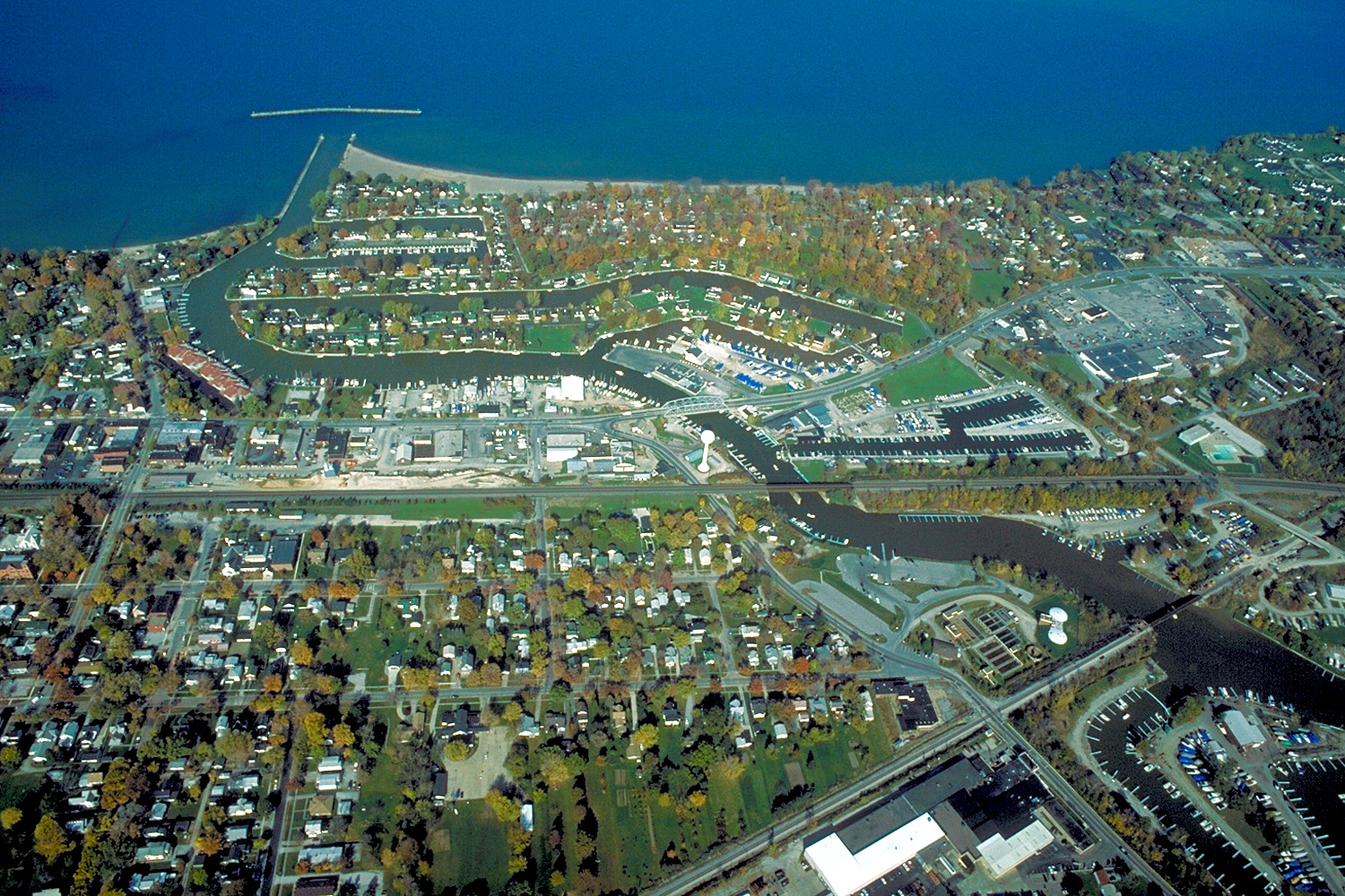
English: Aerial view of Vermilion, Ohio, USA on Lake Erie, near Sandusky, Ohio. The major highway U.S. Route 6 (Liberty Avenue) can be seen running west-east. |
|||
| Data | ||||
| Font |
U.S. Army Corps of Engineers Digital Visual Library Image page Image description page Digital Visual Library home page |
|||
| Autor | Ken Winters, U.S. Army Corps of Engineers | |||
| Permís (Com reutilitzar aquest fitxer) |
|
|||
| Localització | Vermilion, Ohio, USA |
| Posició de la càmera | | Aquesta i altres imatges properes a: OpenStreetMap |
|---|
Historial del fitxer
Cliqueu una data/hora per veure el fitxer tal com era aleshores.
| Data/hora | Miniatura | Dimensions | Usuari/a | Comentari | |
|---|---|---|---|---|---|
| actual | 00:02, 25 març 2007 | | 1.500 × 1.000 (809 Ko) | DanMS | {{Information | Description = {{en|Aerial view of Vermilion, Ohio, USA on Lake Erie, near Sandusky, Ohio. The major highway U.S. Route 6 (Liberty Avenu) can be seen running west-east, then turning to the northeast in the middle of the picture.}} | |
Ús del fitxer
La pàgina següent utilitza aquest fitxer:
Ús global del fitxer
Utilització d'aquest fitxer en altres wikis:
- Utilització a ar.wikipedia.org
- Utilització a arz.wikipedia.org
- Utilització a azb.wikipedia.org
- Utilització a ceb.wikipedia.org
- Utilització a ce.wikipedia.org
- Utilització a cy.wikipedia.org
- Utilització a en.wikipedia.org
- Utilització a en.wikivoyage.org
- Utilització a es.wikipedia.org
- Utilització a eu.wikipedia.org
- Utilització a fa.wikipedia.org
- Utilització a fr.wikipedia.org
- Utilització a ht.wikipedia.org
- Utilització a it.wikivoyage.org
- Utilització a ky.wikipedia.org
- Utilització a lld.wikipedia.org
- Utilització a pl.wikipedia.org
- Utilització a pt.wikipedia.org
- Utilització a simple.wikipedia.org
- Utilització a sr.wikipedia.org
- Utilització a sv.wikipedia.org
- Utilització a tr.wikipedia.org
- Utilització a tt.wikipedia.org
- Utilització a uk.wikipedia.org
- Utilització a vi.wikipedia.org
- Utilització a vo.wikipedia.org
- Utilització a www.wikidata.org
- Utilització a zh-min-nan.wikipedia.org