Fitxer:Golan location map 3.PNG

Mida d'aquesta previsualització: 751 × 600 píxels. Altres resolucions: 301 × 240 píxels | 601 × 480 píxels | 925 × 739 píxels.
Fitxer original (925 × 739 píxels, mida del fitxer: 146 Ko, tipus MIME: image/png)
| Aquest fitxer i la informació mostrada a continuació provenen del dipòsit multimèdia lliure Wikimedia Commons. |
Resum
| Descripció |
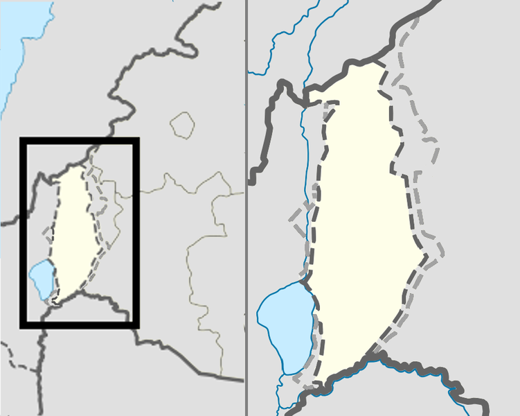
English: Location map of the Golan Heights. |
| Data | (UTC) |
| Font | |
| Autor |
|
| Això és una imatge retocada, cosa que vol dir que ha estat alterada digitalment de la seva versió original. Modificacions: change color of Syria. L'original es pot veure a: Golan location map 2.PNG:
|
Llicència
Jo, el titular dels drets d'autor d'aquest treball, el public sota la següent llicència:
Aquest fitxer està subjecte a la llicència de Creative Commons Reconeixement 3.0 No adaptada.
- Sou lliure de:
- compartir – copiar, distribuir i comunicar públicament l'obra
- adaptar – fer-ne obres derivades
- Amb les condicions següents:
- reconeixement – Heu de donar la informació adequada sobre l'autor, proporcionar un enllaç a la llicència i indicar si s'han realitzat canvis. Podeu fer-ho amb qualsevol mitjà raonable, però de cap manera no suggereixi que l'autor us dóna suport o aprova l'ús que en feu.
Registre original de càrregues
This image is a derivative work of the following images:
- File:Golan_location_map_2.PNG licensed with Cc-by-3.0
- 2011-11-10T18:51:00Z Nableezy 936x739 (143176 Bytes) restore
- 2011-11-10T18:07:48Z Chesdovi 925x739 (149277 Bytes) "a disputed territory may not be presented in a way that supports one of the sides to the conflict"
- 2011-11-10T17:00:35Z Nableezy 936x739 (143176 Bytes) restore
- 2011-11-10T10:36:25Z Biosketch 925x739 (149277 Bytes) The image is displayed throughout Wikipedia and should be used to force a POV..
- 2011-11-10T04:17:35Z Supreme Deliciousness 936x739 (143176 Bytes) Restore neutral map.
- 2011-11-10T03:33:32Z Jiujitsuguy 925x739 (149277 Bytes) Consistent with NPOV showing Heights controlled by neither side
- 2010-12-01T23:42:36Z Supreme Deliciousness 936x739 (143176 Bytes) Smaller fix.
- 2010-12-01T23:15:52Z Supreme Deliciousness 936x739 (143160 Bytes) Border fix.
- 2010-11-25T20:28:54Z Supreme Deliciousness 936x739 (143000 Bytes) smaller fixes
- 2010-11-25T20:21:05Z Supreme Deliciousness 936x739 (131973 Bytes) Smaller fixes.
- 2010-11-10T10:51:46Z Supreme Deliciousness 936x739 (116667 Bytes) Reverting vandalism
- 2010-11-10T07:19:34Z DrorK 925x739 (149277 Bytes) NPOVizing the map. A disputed territory may not be presented in a way that supports one of the sides to the conflict.
- 2010-10-19T18:32:25Z Supreme Deliciousness 936x739 (116667 Bytes) {{Information |Description={{en|1=Location map of the Golan Heights.}} |Source=*[[:File:Syria location map2.svg|Syria location map2.svg]] *[[:File:Israel location map.svg|Israel location map.svg]] |Author=*[[:File:Syria loca
Uploaded with derivativeFX
Historial del fitxer
Cliqueu una data/hora per veure el fitxer tal com era aleshores.
| Data/hora | Miniatura | Dimensions | Usuari/a | Comentari | |
|---|---|---|---|---|---|
| actual | 20:54, 10 nov 2011 | | 925 × 739 (146 Ko) | Nableezy | == {{int:filedesc}} == {{Information |Description={{en|1=Location map of the Golan Heights.}} |Source=*File:Golan_location_map_2.PNG |Date=2011-11-10 18:53 (UTC) |Author=*File:Golan_location_map_2.PNG: *[[:File:Syria location map2.svg|Syria lo |
Ús del fitxer
La pàgina següent utilitza aquest fitxer:
Ús global del fitxer
Utilització d'aquest fitxer en altres wikis:
- Utilització a en.wikipedia.org
- Utilització a es.wikipedia.org